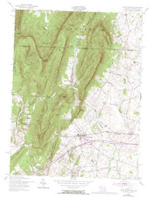
Clear Spring Topo Map Maryland
To zoom in, hover over the map of Clear Spring
USGS Topo Quad 39077f8 - 1:24,000 scale
| Topo Map Name: | Clear Spring |
| USGS Topo Quad ID: | 39077f8 |
| Print Size: | ca. 21 1/4" wide x 27" high |
| Southeast Coordinates: | 39.625° N latitude / 77.875° W longitude |
| Map Center Coordinates: | 39.6875° N latitude / 77.9375° W longitude |
| U.S. States: | MD, PA |
| Filename: | o39077f8.jpg |
| Download Map JPG Image: | Clear Spring topo map 1:24,000 scale |
| Map Type: | Topographic |
| Topo Series: | 7.5´ |
| Map Scale: | 1:24,000 |
| Source of Map Images: | United States Geological Survey (USGS) |
| Alternate Map Versions: |
Clear Spring MD 1955, updated 1956 Download PDF Buy paper map Clear Spring MD 1955, updated 1966 Download PDF Buy paper map Clear Spring MD 1955, updated 1972 Download PDF Buy paper map Clear Spring MD 2011 Download PDF Buy paper map Clear Spring MD 2014 Download PDF Buy paper map Clear Spring MD 2016 Download PDF Buy paper map |
1:24,000 Topo Quads surrounding Clear Spring
> Back to 39077e1 at 1:100,000 scale
> Back to 39076a1 at 1:250,000 scale
> Back to U.S. Topo Maps home
Clear Spring topo map: Gazetteer
Clear Spring: Basins
Blair Valley elevation 283m 928′The Punchbowl elevation 309m 1013′
Clear Spring: Crossings
Interchange 18 elevation 170m 557′Clear Spring: Dams
Blairs Valley Dam elevation 213m 698′Oliver Co Dam elevation 233m 764′
Clear Spring: Gaps
Dunns Gap elevation 466m 1528′Stone Cabin Gap elevation 271m 889′
Clear Spring: Parks
Clear Spring Park elevation 175m 574′Indian Springs Wildlife Demonstration Area elevation 418m 1371′
Clear Spring: Pillars
Hanging Rock elevation 267m 875′Clear Spring: Populated Places
Ashton elevation 135m 442′Big Spring elevation 130m 426′
Charlton elevation 145m 475′
Clear Spring elevation 174m 570′
Dry Run elevation 183m 600′
Forsythe elevation 187m 613′
Kasiesville elevation 182m 597′
Shady Bower elevation 157m 515′
Clear Spring: Post Offices
Clear Spring Post Office elevation 172m 564′Clear Spring: Ranges
Bear Pond Mountains elevation 563m 1847′Clear Spring: Reservoirs
Blairs Valley Lake elevation 213m 698′Clear Spring: Ridges
Stone Quarry Ridge elevation 258m 846′Clear Spring: Springs
Big Spring elevation 126m 413′Clear Spring elevation 167m 547′
Indian Springs elevation 368m 1207′
Clear Spring: Streams
Hinkle Run elevation 218m 715′Indian Springs Run elevation 167m 547′
Little Conococheague Creek elevation 128m 419′
Clear Spring: Summits
Abe Mills Mountain elevation 409m 1341′Boyd Mountain elevation 302m 990′
Bullskin Mountain elevation 471m 1545′
Cross Mountain elevation 627m 2057′
Fairview Mountain elevation 505m 1656′
Gillians Knob elevation 479m 1571′
Hearthstone Mountain elevation 616m 2020′
Johnson Mountain elevation 348m 1141′
Kasies Knob elevation 526m 1725′
Powell Mountain elevation 432m 1417′
Rickard Mountain elevation 472m 1548′
Rickard Mountain elevation 470m 1541′
Sword Mountain elevation 436m 1430′
Two Top Mountain elevation 462m 1515′
Clear Spring: Valleys
Bear Pond Hollow elevation 235m 770′Bear Pond Hollow elevation 212m 695′
Blair Valley elevation 242m 793′
Polecat Hollow elevation 210m 688′
Clear Spring digital topo map on disk
Buy this Clear Spring topo map showing relief, roads, GPS coordinates and other geographical features, as a high-resolution digital map file on DVD:
Atlantic Coast (NY, NJ, PA, DE, MD, VA, NC)
Buy digital topo maps: Atlantic Coast (NY, NJ, PA, DE, MD, VA, NC)


