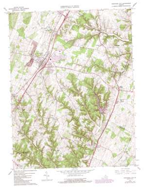
Stephens City Topo Map Virginia
To zoom in, hover over the map of Stephens City
USGS Topo Quad 39078a2 - 1:24,000 scale
| Topo Map Name: | Stephens City |
| USGS Topo Quad ID: | 39078a2 |
| Print Size: | ca. 21 1/4" wide x 27" high |
| Southeast Coordinates: | 39° N latitude / 78.125° W longitude |
| Map Center Coordinates: | 39.0625° N latitude / 78.1875° W longitude |
| U.S. State: | VA |
| Filename: | o39078a2.jpg |
| Download Map JPG Image: | Stephens City topo map 1:24,000 scale |
| Map Type: | Topographic |
| Topo Series: | 7.5´ |
| Map Scale: | 1:24,000 |
| Source of Map Images: | United States Geological Survey (USGS) |
| Alternate Map Versions: |
Stephens City VA 1966, updated 1967 Download PDF Buy paper map Stephens City VA 1966, updated 1978 Download PDF Buy paper map Stephens City VA 1966, updated 1987 Download PDF Buy paper map Stephens City VA 1972, updated 1977 Download PDF Buy paper map Stephens City VA 2010 Download PDF Buy paper map Stephens City VA 2013 Download PDF Buy paper map Stephens City VA 2016 Download PDF Buy paper map |
1:24,000 Topo Quads surrounding Stephens City
> Back to 39078a1 at 1:100,000 scale
> Back to 39078a1 at 1:250,000 scale
> Back to U.S. Topo Maps home
Stephens City topo map: Gazetteer
Stephens City: Crossings
Interchange 307 elevation 221m 725′Interchange 310 elevation 226m 741′
Stephens City: Dams
Lakeside Lake Dam elevation 225m 738′Stephens Park Dam elevation 224m 734′
Wheatlands Dam elevation 194m 636′
Stephens City: Populated Places
Armel elevation 212m 695′Ashby elevation 182m 597′
Bartonsville elevation 219m 718′
Bunker Hill elevation 204m 669′
Canterburg elevation 212m 695′
Gun Barrel Lane Estates elevation 198m 649′
Klines Mill elevation 202m 662′
Lake Frederick elevation 206m 675′
Nineveh elevation 163m 534′
Parkins Mills elevation 195m 639′
Reliance elevation 210m 688′
Ridings Mill elevation 185m 606′
Stephens City elevation 233m 764′
Tulip elevation 216m 708′
Vaucluse elevation 214m 702′
Stephens City: Post Offices
Stephens City Post Office elevation 237m 777′Stephens City: Reservoirs
Lake Frederick elevation 189m 620′Lakeside Lake elevation 225m 738′
Stephens Park Lake elevation 224m 734′
Stephens City: Springs
Vaucluse Spring elevation 214m 702′Stephens City: Streams
Dry Run elevation 160m 524′Hoge Run elevation 196m 643′
Stephens Run elevation 158m 518′
Stephens City digital topo map on disk
Buy this Stephens City topo map showing relief, roads, GPS coordinates and other geographical features, as a high-resolution digital map file on DVD:


