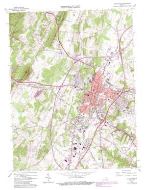
Winchester Topo Map Virginia
To zoom in, hover over the map of Winchester
USGS Topo Quad 39078b2 - 1:24,000 scale
| Topo Map Name: | Winchester |
| USGS Topo Quad ID: | 39078b2 |
| Print Size: | ca. 21 1/4" wide x 27" high |
| Southeast Coordinates: | 39.125° N latitude / 78.125° W longitude |
| Map Center Coordinates: | 39.1875° N latitude / 78.1875° W longitude |
| U.S. State: | VA |
| Filename: | o39078b2.jpg |
| Download Map JPG Image: | Winchester topo map 1:24,000 scale |
| Map Type: | Topographic |
| Topo Series: | 7.5´ |
| Map Scale: | 1:24,000 |
| Source of Map Images: | United States Geological Survey (USGS) |
| Alternate Map Versions: |
Winchester VA 1966, updated 1967 Download PDF Buy paper map Winchester VA 1966, updated 1972 Download PDF Buy paper map Winchester VA 1966, updated 1978 Download PDF Buy paper map Winchester VA 1966, updated 1987 Download PDF Buy paper map Winchester VA 1972, updated 1974 Download PDF Buy paper map Winchester VA 1997, updated 2001 Download PDF Buy paper map Winchester VA 2010 Download PDF Buy paper map Winchester VA 2013 Download PDF Buy paper map Winchester VA 2016 Download PDF Buy paper map |
1:24,000 Topo Quads surrounding Winchester
> Back to 39078a1 at 1:100,000 scale
> Back to 39078a1 at 1:250,000 scale
> Back to U.S. Topo Maps home
Winchester topo map: Gazetteer
Winchester: Airports
Smith Heliport elevation 254m 833′Winchester Medical Center Heliport elevation 253m 830′
Winchester Municipal Airport elevation 218m 715′
Winchester: Crossings
Interchange 313 elevation 209m 685′Interchange 315 elevation 206m 675′
Interchange 317 elevation 214m 702′
Winchester: Dams
Neills Dam (historical) elevation 232m 761′Winchester: Gaps
Hoop Petticoat Gap elevation 278m 912′Winchester: Parks
Frederick Heights Neighborhood Park elevation 205m 672′Harry W Aikens Field elevation 210m 688′
Kernstown Battlefield elevation 235m 770′
Lowry Tennis Courts elevation 200m 656′
Round Hill Neighborhood Park elevation 271m 889′
Winchester Historic District elevation 216m 708′
Winchester Recreation Park elevation 216m 708′
Winchester: Populated Places
Albin elevation 275m 902′Arcadia Mobile Home Park elevation 211m 692′
Ash Hollow Estates elevation 205m 672′
Brookneil elevation 258m 846′
Bufflick Heights elevation 217m 711′
Chambersville elevation 262m 859′
College Park elevation 217m 711′
Country Club Estates elevation 211m 692′
Day - Mar Village elevation 243m 797′
Echo Village elevation 227m 744′
Fairway Estates elevation 209m 685′
Frederick Heights elevation 208m 682′
Green Acres elevation 209m 685′
Heritage Hills elevation 207m 679′
Hill Crest elevation 266m 872′
Jackson Woods elevation 280m 918′
Kernstown elevation 232m 761′
Miller Heights elevation 213m 698′
Nain elevation 306m 1003′
North Frederick Terrace elevation 270m 885′
Opequon elevation 252m 826′
Plainfield Heights elevation 235m 770′
Rolling Fields elevation 200m 656′
Round Hill elevation 273m 895′
Senseny Heights elevation 212m 695′
Shenandoah Mobile Home Park elevation 224m 734′
Sherwood Forest elevation 313m 1026′
Southview elevation 220m 721′
Spring Valley elevation 235m 770′
Stonebrook Farms elevation 260m 853′
Stonewall Orchard elevation 251m 823′
Sunnyside elevation 243m 797′
Valley Acres elevation 240m 787′
Wellington Acres elevation 250m 820′
Westwood elevation 225m 738′
Winchester elevation 216m 708′
Woodchuck Heights elevation 285m 935′
Winchester: Post Offices
Round Hill Post Office elevation 272m 892′Winchester Post Office elevation 218m 715′
Winchester: Ridges
Flint Ridge elevation 338m 1108′Winchester: Springs
Old Town Spring elevation 227m 744′Rouss Spring elevation 201m 659′
Shawnee Spring elevation 209m 685′
Winchester: Streams
Stribling Run elevation 237m 777′Town Run elevation 196m 643′
Winchester: Summits
Bowers Hill elevation 261m 856′Round Hill elevation 425m 1394′
Winchester: Valleys
Purtlebaugh Hollow elevation 218m 715′Winchester digital topo map on disk
Buy this Winchester topo map showing relief, roads, GPS coordinates and other geographical features, as a high-resolution digital map file on DVD:


