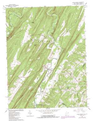
Capon Bridge Topo Map West Virginia
To zoom in, hover over the map of Capon Bridge
USGS Topo Quad 39078c4 - 1:24,000 scale
| Topo Map Name: | Capon Bridge |
| USGS Topo Quad ID: | 39078c4 |
| Print Size: | ca. 21 1/4" wide x 27" high |
| Southeast Coordinates: | 39.25° N latitude / 78.375° W longitude |
| Map Center Coordinates: | 39.3125° N latitude / 78.4375° W longitude |
| U.S. States: | WV, VA |
| Filename: | o39078c4.jpg |
| Download Map JPG Image: | Capon Bridge topo map 1:24,000 scale |
| Map Type: | Topographic |
| Topo Series: | 7.5´ |
| Map Scale: | 1:24,000 |
| Source of Map Images: | United States Geological Survey (USGS) |
| Alternate Map Versions: |
Capon Bridge WV 1965, updated 1967 Download PDF Buy paper map Capon Bridge WV 1965, updated 1979 Download PDF Buy paper map Capon Bridge WV 1965, updated 1987 Download PDF Buy paper map Capon Bridge WV 2011 Download PDF Buy paper map Capon Bridge WV 2014 Download PDF Buy paper map Capon Bridge WV 2016 Download PDF Buy paper map |
1:24,000 Topo Quads surrounding Capon Bridge
> Back to 39078a1 at 1:100,000 scale
> Back to 39078a1 at 1:250,000 scale
> Back to U.S. Topo Maps home
Capon Bridge topo map: Gazetteer
Capon Bridge: Parks
Edwards Run Wildlife Management Area elevation 248m 813′Capon Bridge: Populated Places
Bubbling Spring elevation 256m 839′Capon Bridge elevation 241m 790′
Cold Stream elevation 269m 882′
Capon Bridge: Ridges
Sandy Ridge elevation 510m 1673′Capon Bridge: Springs
Bore Spring elevation 251m 823′Bubbling Spring elevation 251m 823′
Buffalo Gap Spring elevation 292m 958′
Cold Stream Run Spring elevation 270m 885′
Daisy Baker Spring elevation 268m 879′
Hiett Spring elevation 275m 902′
Ice Mountain Spring elevation 261m 856′
Capon Bridge: Streams
Cold Stream elevation 235m 770′Dillons Run elevation 245m 803′
Edwards Run elevation 236m 774′
Johnson Run elevation 304m 997′
Mill Branch elevation 242m 793′
Nixon Run elevation 293m 961′
Old Man Run elevation 248m 813′
Capon Bridge: Summits
Bear Garden Mountain elevation 474m 1555′Butchers Knob elevation 540m 1771′
Darbys Nose elevation 380m 1246′
Georges Peak elevation 537m 1761′
Ice Mountain elevation 451m 1479′
Leith Mountain elevation 484m 1587′
Pine Mountain elevation 537m 1761′
Raven Rocks elevation 364m 1194′
Schaffenaker Mountain elevation 453m 1486′
Slanes Knob elevation 491m 1610′
Capon Bridge: Valleys
Frog Hollow elevation 255m 836′Kale Hollow elevation 251m 823′
Parks Valley elevation 308m 1010′
Riggs Hollow elevation 258m 846′
Sandy Hollow elevation 240m 787′
Stonebridge Hollow elevation 304m 997′
Capon Bridge digital topo map on disk
Buy this Capon Bridge topo map showing relief, roads, GPS coordinates and other geographical features, as a high-resolution digital map file on DVD:


