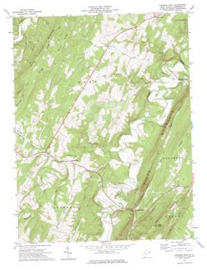
Hanging Rock Topo Map West Virginia
To zoom in, hover over the map of Hanging Rock
USGS Topo Quad 39078c5 - 1:24,000 scale
| Topo Map Name: | Hanging Rock |
| USGS Topo Quad ID: | 39078c5 |
| Print Size: | ca. 21 1/4" wide x 27" high |
| Southeast Coordinates: | 39.25° N latitude / 78.5° W longitude |
| Map Center Coordinates: | 39.3125° N latitude / 78.5625° W longitude |
| U.S. State: | WV |
| Filename: | o39078c5.jpg |
| Download Map JPG Image: | Hanging Rock topo map 1:24,000 scale |
| Map Type: | Topographic |
| Topo Series: | 7.5´ |
| Map Scale: | 1:24,000 |
| Source of Map Images: | United States Geological Survey (USGS) |
| Alternate Map Versions: |
Hanging Rock WV 1973, updated 1975 Download PDF Buy paper map Hanging Rock WV 2011 Download PDF Buy paper map Hanging Rock WV 2014 Download PDF Buy paper map Hanging Rock WV 2016 Download PDF Buy paper map |
1:24,000 Topo Quads surrounding Hanging Rock
> Back to 39078a1 at 1:100,000 scale
> Back to 39078a1 at 1:250,000 scale
> Back to U.S. Topo Maps home
Hanging Rock topo map: Gazetteer
Hanging Rock: Populated Places
Hoy elevation 384m 1259′Loom elevation 448m 1469′
North River Mills elevation 248m 813′
Pleasantdale elevation 321m 1053′
Slanesville elevation 360m 1181′
Hanging Rock: Post Offices
Slanesville Post Office elevation 362m 1187′Hanging Rock: Ridges
Brushy Ridge elevation 392m 1286′Chestnut Oak Ridge elevation 515m 1689′
Devils Backbone elevation 270m 885′
Dunmore Ridge elevation 426m 1397′
Mouser Ridge elevation 478m 1568′
Hanging Rock: Springs
Bitner Spring elevation 257m 843′Craig Spring elevation 252m 826′
Harding Spring elevation 345m 1131′
Luna Roomsburg Spring elevation 417m 1368′
Hanging Rock: Streams
Bearwallow Creek elevation 365m 1197′Gibbons Run elevation 243m 797′
Hiett Run elevation 238m 780′
Maple Run elevation 235m 770′
Pine Draft Run elevation 265m 869′
Tear Coat Creek elevation 253m 830′
Turkeyfoot Run elevation 314m 1030′
Hanging Rock: Summits
Bens Knob elevation 617m 2024′Cooper Mountain elevation 617m 2024′
Little Cacapon Mountain elevation 482m 1581′
Timber Mountain elevation 538m 1765′
Hanging Rock: Valleys
Henderson Hollow elevation 271m 889′Stuart Hollow elevation 285m 935′
Trinton Hollow elevation 269m 882′
Hanging Rock digital topo map on disk
Buy this Hanging Rock topo map showing relief, roads, GPS coordinates and other geographical features, as a high-resolution digital map file on DVD:


