Romney Topo Map West Virginia
To zoom in, hover over the map of Romney
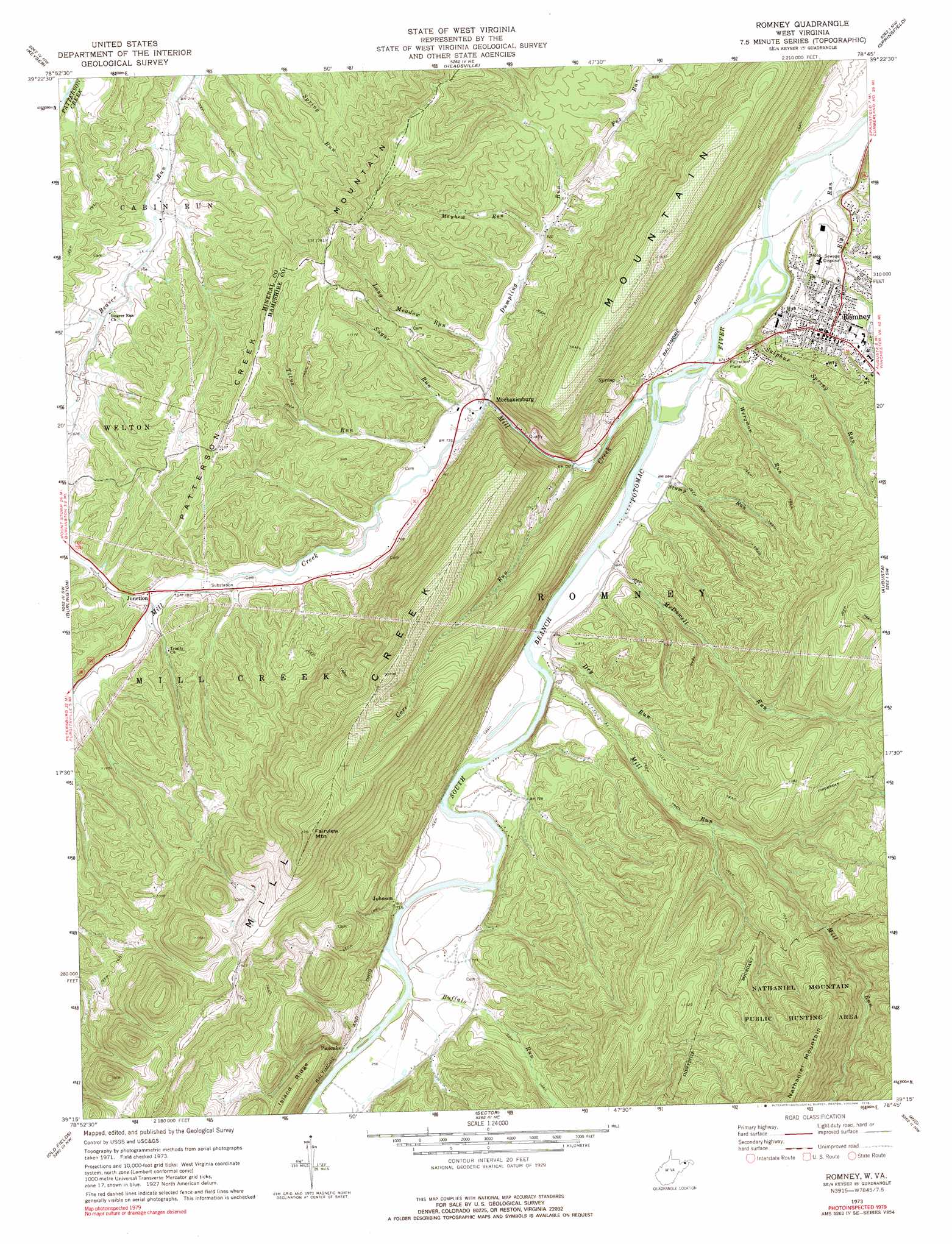
USGS Topo Quad 39078c7 - 1:24,000 scale
| Topo Map Name: | Romney |
| USGS Topo Quad ID: | 39078c7 |
| Print Size: | ca. 21 1/4" wide x 27" high |
| Southeast Coordinates: | 39.25° N latitude / 78.75° W longitude |
| Map Center Coordinates: | 39.3125° N latitude / 78.8125° W longitude |
| U.S. State: | WV |
| Filename: | o39078c7.jpg |
| Download Map JPG Image: | Romney topo map 1:24,000 scale |
| Map Type: | Topographic |
| Topo Series: | 7.5´ |
| Map Scale: | 1:24,000 |
| Source of Map Images: | United States Geological Survey (USGS) |
| Alternate Map Versions: |
Romney WV 1973, updated 1975 Download PDF Buy paper map Romney WV 1973, updated 1975 Download PDF Buy paper map Romney WV 2011 Download PDF Buy paper map Romney WV 2014 Download PDF Buy paper map Romney WV 2016 Download PDF Buy paper map |
1:24,000 Topo Quads surrounding Romney
Barton |
Lonaconing |
Cresaptown |
Patterson Creek |
Oldtown |
Westernport |
Keyser |
Headsville |
Springfield |
Levels |
Antioch |
Burlington |
Romney |
Augusta |
Hanging Rock |
Medley |
Old Fields |
Sector |
Rio |
Yellow Spring |
Rig |
Moorefield |
Needmore |
Baker |
Wardensville |
> Back to 39078a1 at 1:100,000 scale
> Back to 39078a1 at 1:250,000 scale
> Back to U.S. Topo Maps home
Romney topo map: Gazetteer
Romney: Dams
Patterson Creek Structure 27 Dam elevation 231m 757′Romney: Parks
Fort Mill Ridge Wildlife Management Area elevation 293m 961′Romney: Populated Places
Johnson elevation 221m 725′Junction elevation 239m 784′
Mechanicsburg elevation 219m 718′
Pancake elevation 221m 725′
Romney elevation 250m 820′
Romney: Ridges
Mill Creek Mountain elevation 633m 2076′Romney: Springs
Clifford Parker Spring elevation 253m 830′Paul Williams Spring elevation 288m 944′
Romney Spring elevation 267m 875′
Romney: Streams
Big Run elevation 196m 643′Buffalo Run elevation 209m 685′
Core Run elevation 211m 692′
Dry Run elevation 202m 662′
Dumpling Run elevation 217m 711′
Horselick Run elevation 240m 787′
Long Meadow Run elevation 226m 741′
Mayhew Run elevation 250m 820′
McDowell Run elevation 201m 659′
Mill Creek elevation 201m 659′
Mill Run elevation 203m 666′
Stony Run elevation 211m 692′
Stump Run elevation 198m 649′
Sugar Run elevation 218m 715′
Sulphur Spring Run elevation 196m 643′
Titus Run elevation 221m 725′
Wergman Run elevation 197m 646′
Romney: Summits
Fairview Mountain elevation 711m 2332′Romney digital topo map on disk
Buy this Romney topo map showing relief, roads, GPS coordinates and other geographical features, as a high-resolution digital map file on DVD:
 map DVD")