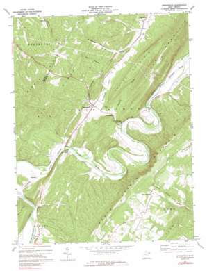
Springfield Topo Map West Virginia
To zoom in, hover over the map of Springfield
USGS Topo Quad 39078d6 - 1:24,000 scale
| Topo Map Name: | Springfield |
| USGS Topo Quad ID: | 39078d6 |
| Print Size: | ca. 21 1/4" wide x 27" high |
| Southeast Coordinates: | 39.375° N latitude / 78.625° W longitude |
| Map Center Coordinates: | 39.4375° N latitude / 78.6875° W longitude |
| U.S. State: | WV |
| Filename: | o39078d6.jpg |
| Download Map JPG Image: | Springfield topo map 1:24,000 scale |
| Map Type: | Topographic |
| Topo Series: | 7.5´ |
| Map Scale: | 1:24,000 |
| Source of Map Images: | United States Geological Survey (USGS) |
| Alternate Map Versions: |
Springfield WV 1973, updated 1975 Download PDF Buy paper map Springfield WV 1973, updated 1989 Download PDF Buy paper map Springfield WV 2011 Download PDF Buy paper map Springfield WV 2014 Download PDF Buy paper map Springfield WV 2016 Download PDF Buy paper map |
1:24,000 Topo Quads surrounding Springfield
> Back to 39078a1 at 1:100,000 scale
> Back to 39078a1 at 1:250,000 scale
> Back to U.S. Topo Maps home
Springfield topo map: Gazetteer
Springfield: Parks
Springfield Wildlife Management Area elevation 470m 1541′Springfield: Populated Places
Blues Beach elevation 196m 643′Donaldson elevation 190m 623′
Grace elevation 191m 626′
Milleson elevation 239m 784′
Millesons Mill elevation 184m 603′
Raven Rocks elevation 192m 629′
Ridgedale elevation 199m 652′
Ritters elevation 197m 646′
Springfield elevation 224m 734′
Three Churches elevation 400m 1312′
Vance elevation 201m 659′
Wapocomo elevation 199m 652′
Springfield: Post Offices
Springfield Post Office elevation 235m 770′Three Churches Post Office elevation 397m 1302′
Springfield: Ridges
Buck Ridge elevation 354m 1161′Middle Ridge elevation 484m 1587′
Springfield: Springs
Huffman Spring elevation 212m 695′Raven Rock Spring elevation 189m 620′
Springfield Spring elevation 185m 606′
Springfield: Streams
Abernathy Run elevation 179m 587′Buffalo Creek elevation 195m 639′
Fox Run elevation 192m 629′
Johns Run elevation 186m 610′
Springfield: Summits
River Mountain elevation 558m 1830′Valley Mountain elevation 435m 1427′
Springfield: Valleys
Greenwood Hollow elevation 213m 698′Short Hollow elevation 250m 820′
Springfield Valley elevation 214m 702′
Swisher Hollow elevation 198m 649′
Springfield digital topo map on disk
Buy this Springfield topo map showing relief, roads, GPS coordinates and other geographical features, as a high-resolution digital map file on DVD:


