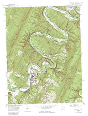
Paw Paw Topo Map West Virginia
To zoom in, hover over the map of Paw Paw
USGS Topo Quad 39078e4 - 1:24,000 scale
| Topo Map Name: | Paw Paw |
| USGS Topo Quad ID: | 39078e4 |
| Print Size: | ca. 21 1/4" wide x 27" high |
| Southeast Coordinates: | 39.5° N latitude / 78.375° W longitude |
| Map Center Coordinates: | 39.5625° N latitude / 78.4375° W longitude |
| U.S. States: | WV, MD |
| Filename: | o39078e4.jpg |
| Download Map JPG Image: | Paw Paw topo map 1:24,000 scale |
| Map Type: | Topographic |
| Topo Series: | 7.5´ |
| Map Scale: | 1:24,000 |
| Source of Map Images: | United States Geological Survey (USGS) |
| Alternate Map Versions: |
Paw Paw WV 1950, updated 1967 Download PDF Buy paper map Paw Paw WV 1950, updated 1975 Download PDF Buy paper map Paw Paw WV 1950, updated 1989 Download PDF Buy paper map Paw Paw WV 1951 Download PDF Buy paper map Paw Paw WV 1996, updated 2001 Download PDF Buy paper map Paw Paw WV 2011 Download PDF Buy paper map Paw Paw WV 2014 Download PDF Buy paper map Paw Paw WV 2016 Download PDF Buy paper map |
1:24,000 Topo Quads surrounding Paw Paw
> Back to 39078e1 at 1:100,000 scale
> Back to 39078a1 at 1:250,000 scale
> Back to U.S. Topo Maps home
Paw Paw topo map: Gazetteer
Paw Paw: Areas
Paw Paw Bends elevation 148m 485′Paw Paw: Bends
Bevan Bend elevation 167m 547′Paw Paw: Bridges
Fifteen Mile Creek Aqueduct elevation 135m 442′Paw Paw: Capes
Piney Point elevation 515m 1689′Stinebaugh Point elevation 507m 1663′
Paw Paw: Dams
Lock 58 elevation 152m 498′Lock 59 elevation 142m 465′
Lock 60 elevation 143m 469′
Lock 61 elevation 142m 465′
Paw Paw: Falls
Niagara Falls elevation 199m 652′Paw Paw: Flats
Reckley Flat elevation 189m 620′Paw Paw: Populated Places
Campbells elevation 151m 495′Doe Gully elevation 152m 498′
Fairplay elevation 160m 524′
Green Ridge elevation 162m 531′
Green Ridge elevation 166m 544′
Hansrote elevation 185m 606′
Jerome elevation 155m 508′
Keifers elevation 160m 524′
Little Cacapon elevation 159m 521′
Magnolia elevation 155m 508′
Orleans Cross Roads elevation 154m 505′
Paw Paw elevation 174m 570′
Paw Paw: Ridges
Anthony Ridge elevation 352m 1154′Paw Paw Ridge elevation 262m 859′
Sideling Hill elevation 612m 2007′
Sorrell Ridge elevation 288m 944′
The Devils Nose elevation 316m 1036′
Paw Paw: Springs
Robert Milborn Spring elevation 143m 469′Paw Paw: Streams
Big Run elevation 149m 488′Bullet Run elevation 173m 567′
Dawson Run elevation 153m 501′
Fifteenmile Creek elevation 133m 436′
Little Cacapon River elevation 156m 511′
Little Steer Run elevation 147m 482′
Purslane Run elevation 153m 501′
Sharon Run elevation 203m 666′
Steer Run elevation 147m 482′
Paw Paw: Summits
Bevan Hill elevation 204m 669′Paw Paw: Tunnels
Carothers Tunnel elevation 208m 682′Graham Tunnel elevation 279m 915′
Kesler Tunnel elevation 206m 675′
Paw Paw Tunnel elevation 248m 813′
Randolph Tunnel elevation 215m 705′
Stickpile Tunnel elevation 228m 748′
Stuart Tunnel elevation 216m 708′
Paw Paw: Valleys
Beanpatch Hollow elevation 140m 459′Chriswell Hollow elevation 164m 538′
Devils Alley elevation 141m 462′
Freestone Hollow elevation 169m 554′
Gross Hollow elevation 152m 498′
Gross Hollow elevation 149m 488′
Hales Hollow elevation 156m 511′
Hansrote Hollow elevation 168m 551′
Johnson Hollow elevation 239m 784′
Kate Hollow elevation 162m 531′
Lapley Hollow elevation 159m 521′
Larrys Hollow elevation 161m 528′
Macks Hollow elevation 151m 495′
Marts Hollow elevation 160m 524′
Montgomery Hollow elevation 190m 623′
Nancy Hollow elevation 195m 639′
Roby Hollow elevation 146m 479′
Rock Lick Hollow elevation 200m 656′
Sandy Flat Hollow elevation 147m 482′
Shambaugh Hollow elevation 157m 515′
Shanty Hollow elevation 213m 698′
Smith Hollow elevation 161m 528′
Sprigs Hollow elevation 166m 544′
Spring Hollow elevation 186m 610′
Station Hollow elevation 149m 488′
The Nose Hollow elevation 167m 547′
Trofton Hollow elevation 171m 561′
Tunnel Hollow elevation 146m 479′
Paw Paw digital topo map on disk
Buy this Paw Paw topo map showing relief, roads, GPS coordinates and other geographical features, as a high-resolution digital map file on DVD:


