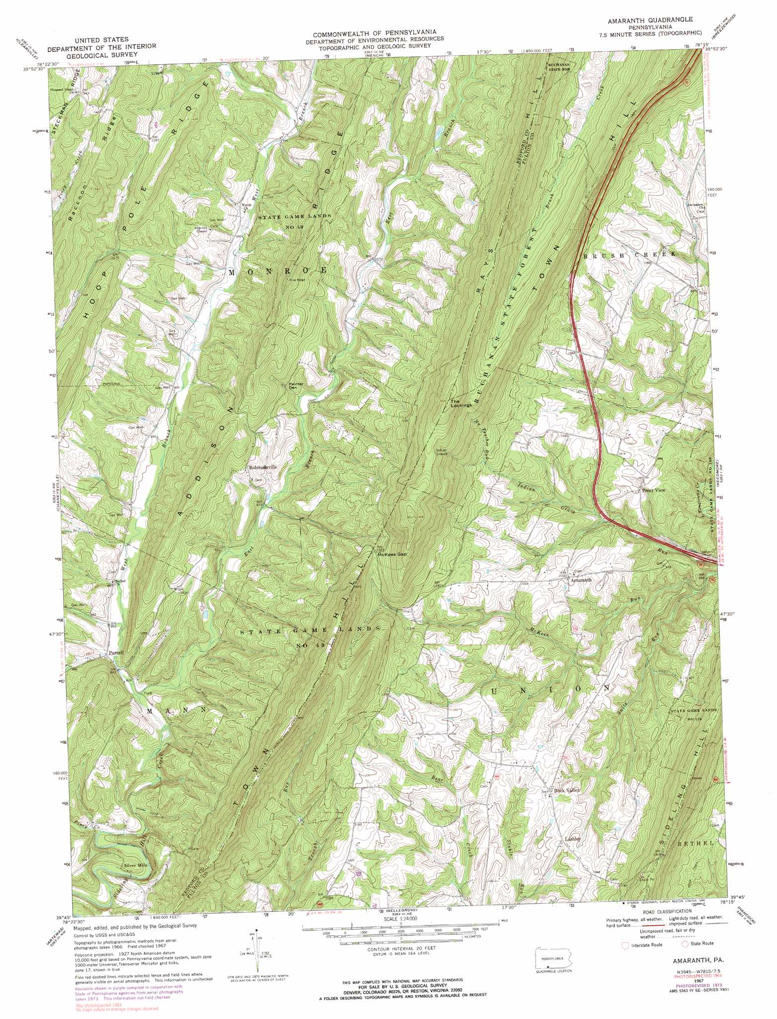
Amaranth Topo Map Pennsylvania
To zoom in, hover over the map of Amaranth
USGS Topo Quad 39078g3 - 1:24,000 scale
| Topo Map Name: | Amaranth |
| USGS Topo Quad ID: | 39078g3 |
| Print Size: | ca. 21 1/4" wide x 27" high |
| Southeast Coordinates: | 39.75° N latitude / 78.25° W longitude |
| Map Center Coordinates: | 39.8125° N latitude / 78.3125° W longitude |
| U.S. State: | PA |
| Filename: | o39078g3.jpg |
| Download Map JPG Image: | Amaranth topo map 1:24,000 scale |
| Map Type: | Topographic |
| Topo Series: | 7.5´ |
| Map Scale: | 1:24,000 |
| Source of Map Images: | United States Geological Survey (USGS) |
| Alternate Map Versions: |
Amaranth PA 1967, updated 1970 Download PDF Buy paper map Amaranth PA 1967, updated 1973 Download PDF Buy paper map Amaranth PA 1967, updated 1983 Download PDF Buy paper map Amaranth PA 1967, updated 1990 Download PDF Buy paper map Amaranth PA 1994, updated 1997 Download PDF Buy paper map Amaranth PA 2010 Download PDF Buy paper map Amaranth PA 2013 Download PDF Buy paper map Amaranth PA 2016 Download PDF Buy paper map |
1:24,000 Topo Quads surrounding Amaranth
Bedford |
Everett West |
Everett East |
Wells Tannery |
Hustontown |
Rainsburg |
Clearville |
Mench |
Breezewood |
Meadow Grounds |
Beans Cove |
Chaneysville |
Amaranth |
Needmore |
Big Cove Tannery |
Flintstone |
Artemas |
Bellegrove |
Hancock |
Cherry Run |
Oldtown |
Paw Paw |
Great Cacapon |
Stotlers Crossroads |
Big Pool |
> Back to 39078e1 at 1:100,000 scale
> Back to 39078a1 at 1:250,000 scale
> Back to U.S. Topo Maps home
Amaranth topo map: Gazetteer
Amaranth: Gaps
McKees Gap elevation 424m 1391′Amaranth: Parks
State Game Lands Number 49 elevation 371m 1217′Amaranth: Populated Places
Amaranth elevation 309m 1013′Buck Valley elevation 320m 1049′
Lashley elevation 315m 1033′
Point View elevation 303m 994′
Purcell elevation 259m 849′
Robinsonville elevation 332m 1089′
Silver Mills elevation 236m 774′
Amaranth: Ridges
Addison Ridge elevation 469m 1538′Hoop Pole Ridge elevation 435m 1427′
Raccoon Ridge elevation 461m 1512′
Amaranth: Streams
East Branch Sideling Hill Creek elevation 253m 830′No Touchee Run elevation 350m 1148′
Piney Creek elevation 237m 777′
Shark Run elevation 260m 853′
Snite Run elevation 209m 685′
West Branch Sideling Hill Creek elevation 253m 830′
Amaranth: Summits
Negro Mountain elevation 546m 1791′The Lockings elevation 618m 2027′
Amaranth: Trails
Big Flat Trail elevation 483m 1584′Amaranth: Valleys
Painter Den elevation 334m 1095′Amaranth digital topo map on disk
Buy this Amaranth topo map showing relief, roads, GPS coordinates and other geographical features, as a high-resolution digital map file on DVD:
 map DVD")