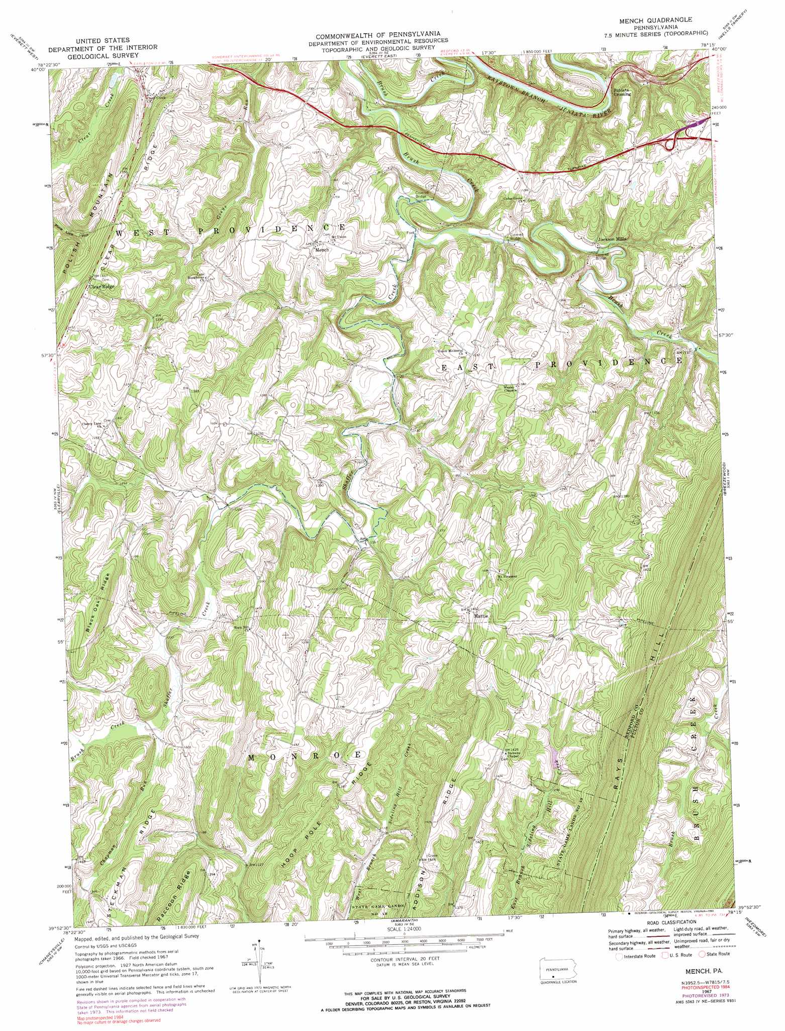
Mench Topo Map Pennsylvania
To zoom in, hover over the map of Mench
USGS Topo Quad 39078h3 - 1:24,000 scale
| Topo Map Name: | Mench |
| USGS Topo Quad ID: | 39078h3 |
| Print Size: | ca. 21 1/4" wide x 27" high |
| Southeast Coordinates: | 39.875° N latitude / 78.25° W longitude |
| Map Center Coordinates: | 39.9375° N latitude / 78.3125° W longitude |
| U.S. State: | PA |
| Filename: | o39078h3.jpg |
| Download Map JPG Image: | Mench topo map 1:24,000 scale |
| Map Type: | Topographic |
| Topo Series: | 7.5´ |
| Map Scale: | 1:24,000 |
| Source of Map Images: | United States Geological Survey (USGS) |
| Alternate Map Versions: |
Mench PA 1967, updated 1970 Download PDF Buy paper map Mench PA 1967, updated 1973 Download PDF Buy paper map Mench PA 1967, updated 1990 Download PDF Buy paper map Mench PA 1994, updated 1997 Download PDF Buy paper map Mench PA 2010 Download PDF Buy paper map Mench PA 2013 Download PDF Buy paper map Mench PA 2016 Download PDF Buy paper map |
1:24,000 Topo Quads surrounding Mench
Alum Bank |
New Enterprise |
Hopewell |
Saxton |
Saltillo |
Bedford |
Everett West |
Everett East |
Wells Tannery |
Hustontown |
Rainsburg |
Clearville |
Mench |
Breezewood |
Meadow Grounds |
Beans Cove |
Chaneysville |
Amaranth |
Needmore |
Big Cove Tannery |
Flintstone |
Artemas |
Bellegrove |
Hancock |
Cherry Run |
> Back to 39078e1 at 1:100,000 scale
> Back to 39078a1 at 1:250,000 scale
> Back to U.S. Topo Maps home
Mench topo map: Gazetteer
Mench: Bridges
Felten's Covered Bridge elevation 322m 1056′Jackson's Mill Covered Bridge elevation 332m 1089′
Mench: Populated Places
Clear Ridge elevation 440m 1443′Emerson elevation 414m 1358′
Jackson Mills elevation 339m 1112′
Juniata Crossing elevation 296m 971′
Mattie elevation 447m 1466′
Mench elevation 392m 1286′
Mench: Ridges
Rays Hill elevation 580m 1902′Mench: Streams
Brush Creek elevation 378m 1240′Chapman Run elevation 378m 1240′
Shaffer Creek elevation 320m 1049′
Weimer Run elevation 388m 1272′
Mench: Valleys
Wildcat Hollow elevation 379m 1243′Mench digital topo map on disk
Buy this Mench topo map showing relief, roads, GPS coordinates and other geographical features, as a high-resolution digital map file on DVD:
 map DVD")