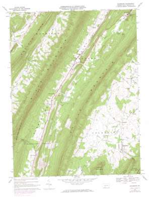
Rainsburg Topo Map Pennsylvania
To zoom in, hover over the map of Rainsburg
USGS Topo Quad 39078h5 - 1:24,000 scale
| Topo Map Name: | Rainsburg |
| USGS Topo Quad ID: | 39078h5 |
| Print Size: | ca. 21 1/4" wide x 27" high |
| Southeast Coordinates: | 39.875° N latitude / 78.5° W longitude |
| Map Center Coordinates: | 39.9375° N latitude / 78.5625° W longitude |
| U.S. State: | PA |
| Filename: | o39078h5.jpg |
| Download Map JPG Image: | Rainsburg topo map 1:24,000 scale |
| Map Type: | Topographic |
| Topo Series: | 7.5´ |
| Map Scale: | 1:24,000 |
| Source of Map Images: | United States Geological Survey (USGS) |
| Alternate Map Versions: |
Rainsburg PA 1967, updated 1970 Download PDF Buy paper map Rainsburg PA 1967, updated 1973 Download PDF Buy paper map Rainsburg PA 1967, updated 1984 Download PDF Buy paper map Rainsburg PA 1967, updated 1984 Download PDF Buy paper map Rainsburg PA 2010 Download PDF Buy paper map Rainsburg PA 2013 Download PDF Buy paper map Rainsburg PA 2016 Download PDF Buy paper map |
1:24,000 Topo Quads surrounding Rainsburg
> Back to 39078e1 at 1:100,000 scale
> Back to 39078a1 at 1:250,000 scale
> Back to U.S. Topo Maps home
Rainsburg topo map: Gazetteer
Rainsburg: Basins
Cumberland Valley elevation 418m 1371′Rainsburg: Populated Places
Bedford Springs elevation 359m 1177′Beegleton elevation 389m 1276′
Burning Bush elevation 402m 1318′
Charlesville elevation 400m 1312′
Rainsburg elevation 429m 1407′
Sulphur Springs elevation 411m 1348′
Rainsburg: Post Offices
Sulphur Springs Post Office (historical) elevation 411m 1348′Rainsburg: Reservoirs
Red Oaks Lakes elevation 350m 1148′Rainsburg: Springs
Black Spring elevation 360m 1181′Crystal Spring elevation 353m 1158′
Magnesium Spring elevation 348m 1141′
White Sulpher Springs elevation 412m 1351′
Rainsburg: Streams
Sand Spring Run elevation 381m 1250′Sulphur Springs Creek elevation 359m 1177′
Rainsburg: Valleys
Milligan Cove elevation 401m 1315′Rainsburg digital topo map on disk
Buy this Rainsburg topo map showing relief, roads, GPS coordinates and other geographical features, as a high-resolution digital map file on DVD:


