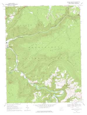
Mozark Mountain Topo Map West Virginia
To zoom in, hover over the map of Mozark Mountain
USGS Topo Quad 39079a5 - 1:24,000 scale
| Topo Map Name: | Mozark Mountain |
| USGS Topo Quad ID: | 39079a5 |
| Print Size: | ca. 21 1/4" wide x 27" high |
| Southeast Coordinates: | 39° N latitude / 79.5° W longitude |
| Map Center Coordinates: | 39.0625° N latitude / 79.5625° W longitude |
| U.S. State: | WV |
| Filename: | o39079a5.jpg |
| Download Map JPG Image: | Mozark Mountain topo map 1:24,000 scale |
| Map Type: | Topographic |
| Topo Series: | 7.5´ |
| Map Scale: | 1:24,000 |
| Source of Map Images: | United States Geological Survey (USGS) |
| Alternate Map Versions: |
Mozark Mountain WV 1968, updated 1972 Download PDF Buy paper map Mozark Mountain WV 1968, updated 1976 Download PDF Buy paper map Mozark Mountain WV 1995, updated 1998 Download PDF Buy paper map Mozark Mountain WV 1995, updated 1998 Download PDF Buy paper map Mozark Mountain WV 2011 Download PDF Buy paper map Mozark Mountain WV 2014 Download PDF Buy paper map Mozark Mountain WV 2016 Download PDF Buy paper map |
| FStopo: | US Forest Service topo Mozark Mountain is available: Download FStopo PDF Download FStopo TIF |
1:24,000 Topo Quads surrounding Mozark Mountain
> Back to 39079a1 at 1:100,000 scale
> Back to 39078a1 at 1:250,000 scale
> Back to U.S. Topo Maps home
Mozark Mountain topo map: Gazetteer
Mozark Mountain: Populated Places
Elk elevation 774m 2539′Gladwin elevation 596m 1955′
Lime Rock (historical) elevation 580m 1902′
Mackeyville elevation 789m 2588′
Mill Run (historical) elevation 581m 1906′
Richford (historical) elevation 568m 1863′
Rosendorf elevation 543m 1781′
Mozark Mountain: Ranges
Backbone Mountain elevation 1113m 3651′Mozark Mountain: Springs
Kent Lambert Spring elevation 571m 1873′Lester Falnagan Spring elevation 559m 1833′
Mozark Mountain: Streams
Big Run elevation 605m 1984′Cave Run elevation 566m 1856′
Coal Run elevation 558m 1830′
Elklick Run elevation 580m 1902′
Finley Run elevation 694m 2276′
Flat Rock Run elevation 562m 1843′
Glady Fork elevation 593m 1945′
Hickory Lick Run elevation 536m 1758′
Laurel Run elevation 526m 1725′
Lindy Run elevation 668m 2191′
Mill Run elevation 575m 1886′
North Fork Blackwater River elevation 725m 2378′
North Fork Red Run elevation 980m 3215′
Otter Creek elevation 543m 1781′
Pendleton Creek elevation 791m 2595′
Pond Creek elevation 697m 2286′
Red Run elevation 551m 1807′
Shavers Lick Run elevation 556m 1824′
South Fork Red Run elevation 980m 3215′
Spruce Lick Run elevation 550m 1804′
Tub Run elevation 644m 2112′
Mozark Mountain: Summits
Green Mountain elevation 1069m 3507′Mozark Mountain elevation 1169m 3835′
Mozark Mountain: Trails
Bennet Rock Trail elevation 670m 2198′Boundary Trail elevation 978m 3208′
Canyon Rim Trail elevation 1015m 3330′
Flat Rock Trail elevation 852m 2795′
Limerock Trail elevation 713m 2339′
Lindy Run Trail elevation 1013m 3323′
Mountain Side Trail elevation 819m 2687′
Plantation Trail elevation 1067m 3500′
Mozark Mountain digital topo map on disk
Buy this Mozark Mountain topo map showing relief, roads, GPS coordinates and other geographical features, as a high-resolution digital map file on DVD:


