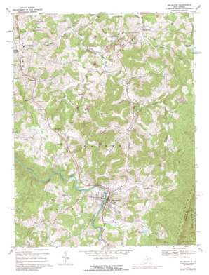
Belington Topo Map West Virginia
To zoom in, hover over the map of Belington
USGS Topo Quad 39079a8 - 1:24,000 scale
| Topo Map Name: | Belington |
| USGS Topo Quad ID: | 39079a8 |
| Print Size: | ca. 21 1/4" wide x 27" high |
| Southeast Coordinates: | 39° N latitude / 79.875° W longitude |
| Map Center Coordinates: | 39.0625° N latitude / 79.9375° W longitude |
| U.S. State: | WV |
| Filename: | o39079a8.jpg |
| Download Map JPG Image: | Belington topo map 1:24,000 scale |
| Map Type: | Topographic |
| Topo Series: | 7.5´ |
| Map Scale: | 1:24,000 |
| Source of Map Images: | United States Geological Survey (USGS) |
| Alternate Map Versions: |
Belington WV 1969, updated 1971 Download PDF Buy paper map Belington WV 1969, updated 1977 Download PDF Buy paper map Belington WV 1969, updated 1989 Download PDF Buy paper map Belington WV 2011 Download PDF Buy paper map Belington WV 2014 Download PDF Buy paper map Belington WV 2016 Download PDF Buy paper map |
1:24,000 Topo Quads surrounding Belington
> Back to 39079a1 at 1:100,000 scale
> Back to 39078a1 at 1:250,000 scale
> Back to U.S. Topo Maps home
Belington topo map: Gazetteer
Belington: Crossings
Wilmoth Ford elevation 506m 1660′Belington: Dams
Town of Belington Water Supply Dam elevation 588m 1929′Belington: Populated Places
Alston elevation 527m 1729′Belington elevation 519m 1702′
Calhoun elevation 585m 1919′
Corley elevation 553m 1814′
Flora (historical) elevation 539m 1768′
Huffman (historical) elevation 514m 1686′
Jones elevation 635m 2083′
Lehigh (historical) elevation 518m 1699′
McLean (historical) elevation 519m 1702′
Meadowville elevation 479m 1571′
Stringtown elevation 528m 1732′
Valley Bend elevation 599m 1965′
Wilmoth (historical) elevation 509m 1669′
Belington: Post Offices
Belington Post Office elevation 520m 1706′Belington: Reservoirs
Mill Creek Reservoir elevation 589m 1932′Belington: Ridges
Sand Ridge elevation 536m 1758′Belington: Streams
Baker Run elevation 518m 1699′Bear Run elevation 481m 1578′
Big Run elevation 515m 1689′
Bills Creek elevation 477m 1564′
Hunter Fork elevation 485m 1591′
Long Run elevation 494m 1620′
Mill Creek elevation 516m 1692′
Mouse Run elevation 543m 1781′
Mud Run elevation 480m 1574′
Shooks Run elevation 516m 1692′
Toms Run elevation 517m 1696′
Whitman Run elevation 474m 1555′
Wolf Run elevation 502m 1646′
Belington: Valleys
Koontz Hollow elevation 503m 1650′Belington digital topo map on disk
Buy this Belington topo map showing relief, roads, GPS coordinates and other geographical features, as a high-resolution digital map file on DVD:


