Medley Topo Map West Virginia
To zoom in, hover over the map of Medley
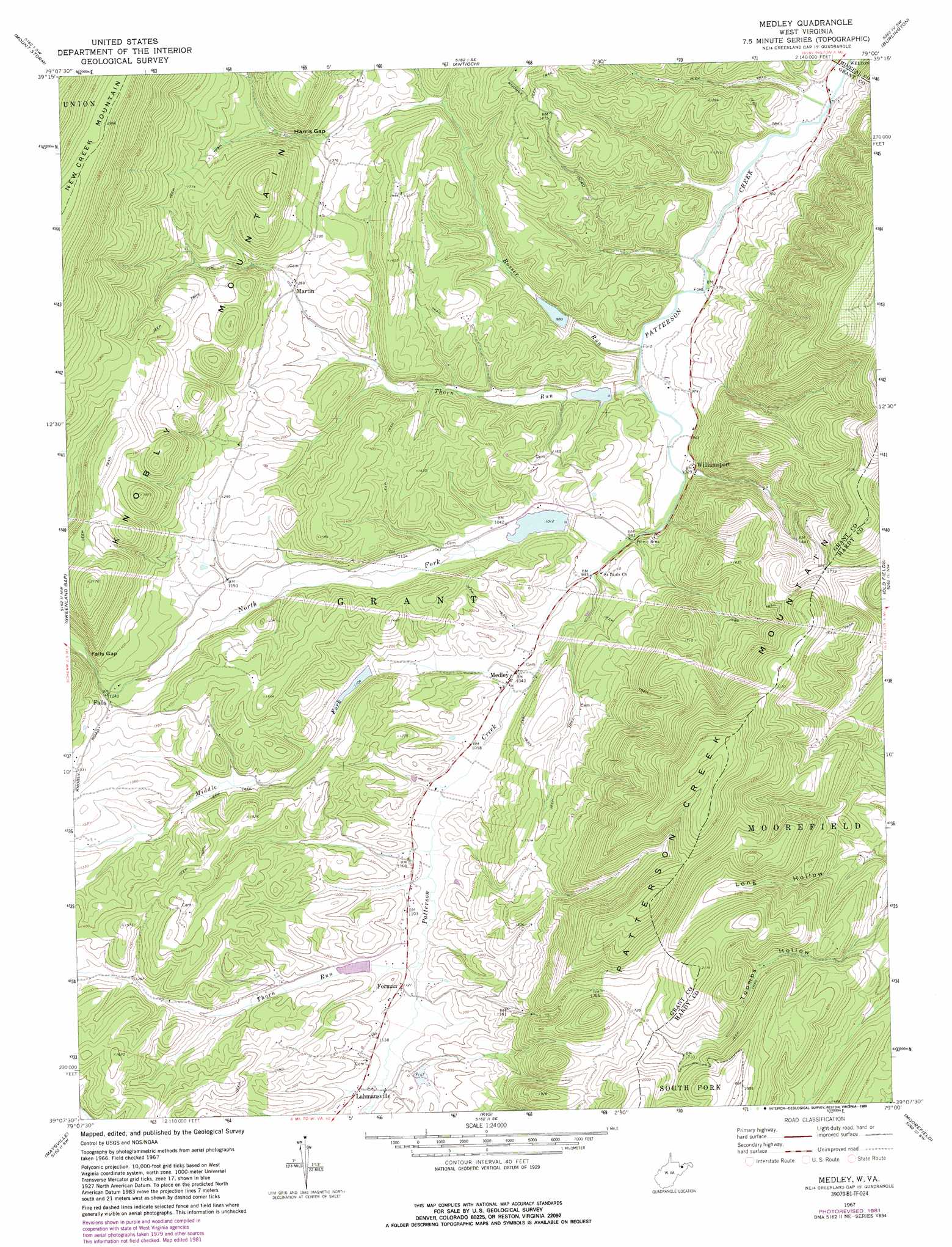
USGS Topo Quad 39079b1 - 1:24,000 scale
| Topo Map Name: | Medley |
| USGS Topo Quad ID: | 39079b1 |
| Print Size: | ca. 21 1/4" wide x 27" high |
| Southeast Coordinates: | 39.125° N latitude / 79° W longitude |
| Map Center Coordinates: | 39.1875° N latitude / 79.0625° W longitude |
| U.S. State: | WV |
| Filename: | o39079b1.jpg |
| Download Map JPG Image: | Medley topo map 1:24,000 scale |
| Map Type: | Topographic |
| Topo Series: | 7.5´ |
| Map Scale: | 1:24,000 |
| Source of Map Images: | United States Geological Survey (USGS) |
| Alternate Map Versions: |
Medley WV 1967, updated 1972 Download PDF Buy paper map Medley WV 1967, updated 1977 Download PDF Buy paper map Medley WV 1967, updated 1982 Download PDF Buy paper map Medley WV 1967, updated 1989 Download PDF Buy paper map Medley WV 2011 Download PDF Buy paper map Medley WV 2014 Download PDF Buy paper map Medley WV 2016 Download PDF Buy paper map |
1:24,000 Topo Quads surrounding Medley
Deer Park |
Kitzmiller |
Westernport |
Keyser |
Headsville |
Gorman |
Mount Storm |
Antioch |
Burlington |
Romney |
Mount Storm Lake |
Greenland Gap |
Medley |
Old Fields |
Sector |
Blackbird Knob |
Maysville |
Rig |
Moorefield |
Needmore |
Hopeville |
Petersburg West |
Petersburg East |
Lost River State Park |
Lost City |
> Back to 39079a1 at 1:100,000 scale
> Back to 39078a1 at 1:250,000 scale
> Back to U.S. Topo Maps home
Medley topo map: Gazetteer
Medley: Dams
Patterson Creek Structure 12 Dam elevation 294m 964′Patterson Creek Structure 13 Dam elevation 305m 1000′
Patterson Creek Structure 41 Dam elevation 312m 1023′
Patterson Creek Structure 49 Dam elevation 346m 1135′
Patterson Creek Structure Four Dam elevation 344m 1128′
Patterson Creek Structure Three Dam elevation 355m 1164′
Patterson Creek Structure Two Dam elevation 343m 1125′
Medley: Gaps
Falls Gap elevation 393m 1289′Harris Gap elevation 418m 1371′
Medley: Populated Places
Falls elevation 382m 1253′Forman elevation 342m 1122′
Lahmansville elevation 344m 1128′
Martin elevation 385m 1263′
Medley elevation 322m 1056′
Williamsport elevation 312m 1023′
Medley: Post Offices
Lahmansville Post Office elevation 341m 1118′Medley Post Office elevation 318m 1043′
Medley: Springs
Waterfall Spring elevation 555m 1820′Wolf Den Spring elevation 621m 2037′
Medley: Streams
Middle Fork Patterson Creek elevation 313m 1026′North Fork Patterson Creek elevation 296m 971′
Rosser Run elevation 278m 912′
Thorn Run elevation 331m 1085′
Thorn Run elevation 280m 918′
Medley: Valleys
Long Hollow elevation 370m 1213′Medley digital topo map on disk
Buy this Medley topo map showing relief, roads, GPS coordinates and other geographical features, as a high-resolution digital map file on DVD:
 map DVD")