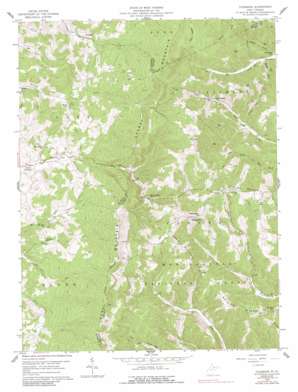
Colebank Topo Map West Virginia
To zoom in, hover over the map of Colebank
USGS Topo Quad 39079b7 - 1:24,000 scale
| Topo Map Name: | Colebank |
| USGS Topo Quad ID: | 39079b7 |
| Print Size: | ca. 21 1/4" wide x 27" high |
| Southeast Coordinates: | 39.125° N latitude / 79.75° W longitude |
| Map Center Coordinates: | 39.1875° N latitude / 79.8125° W longitude |
| U.S. State: | WV |
| Filename: | o39079b7.jpg |
| Download Map JPG Image: | Colebank topo map 1:24,000 scale |
| Map Type: | Topographic |
| Topo Series: | 7.5´ |
| Map Scale: | 1:24,000 |
| Source of Map Images: | United States Geological Survey (USGS) |
| Alternate Map Versions: |
Colebank WV 1959, updated 1961 Download PDF Buy paper map Colebank WV 1959, updated 1977 Download PDF Buy paper map Colebank WV 1959, updated 1984 Download PDF Buy paper map Colebank WV 1959, updated 1991 Download PDF Buy paper map Colebank WV 1995, updated 1998 Download PDF Buy paper map Colebank WV 2011 Download PDF Buy paper map Colebank WV 2014 Download PDF Buy paper map Colebank WV 2016 Download PDF Buy paper map |
| FStopo: | US Forest Service topo Colebank is available: Download FStopo PDF Download FStopo TIF |
1:24,000 Topo Quads surrounding Colebank
> Back to 39079a1 at 1:100,000 scale
> Back to 39078a1 at 1:250,000 scale
> Back to U.S. Topo Maps home
Colebank topo map: Gazetteer
Colebank: Populated Places
Colebank elevation 441m 1446′Hobson (historical) elevation 579m 1899′
Hovatter elevation 512m 1679′
Texas (historical) elevation 823m 2700′
Colebank: Ridges
Laurel Mountain elevation 957m 3139′Mount Zion Ridge elevation 785m 2575′
Colebank: Streams
Cherry Run elevation 542m 1778′Jacobs Run elevation 510m 1673′
Stony Run elevation 447m 1466′
Colebank: Summits
Pifer Mountain elevation 835m 2739′Texas Mountain elevation 857m 2811′
Colebank: Valleys
Bearpen Hollow elevation 505m 1656′Colebank digital topo map on disk
Buy this Colebank topo map showing relief, roads, GPS coordinates and other geographical features, as a high-resolution digital map file on DVD:


