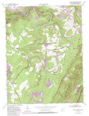
Mount Storm Topo Map West Virginia
To zoom in, hover over the map of Mount Storm
USGS Topo Quad 39079c2 - 1:24,000 scale
| Topo Map Name: | Mount Storm |
| USGS Topo Quad ID: | 39079c2 |
| Print Size: | ca. 21 1/4" wide x 27" high |
| Southeast Coordinates: | 39.25° N latitude / 79.125° W longitude |
| Map Center Coordinates: | 39.3125° N latitude / 79.1875° W longitude |
| U.S. States: | WV, MD |
| Filename: | o39079c2.jpg |
| Download Map JPG Image: | Mount Storm topo map 1:24,000 scale |
| Map Type: | Topographic |
| Topo Series: | 7.5´ |
| Map Scale: | 1:24,000 |
| Source of Map Images: | United States Geological Survey (USGS) |
| Alternate Map Versions: |
Mount Storm WV 1949, updated 1972 Download PDF Buy paper map Mount Storm WV 1949, updated 1975 Download PDF Buy paper map Mount Storm WV 1949, updated 1982 Download PDF Buy paper map Mount Storm WV 1949, updated 1987 Download PDF Buy paper map Mount Storm WV 1951 Download PDF Buy paper map Mount Storm WV 1997, updated 2001 Download PDF Buy paper map Mount Storm WV 2011 Download PDF Buy paper map Mount Storm WV 2014 Download PDF Buy paper map Mount Storm WV 2016 Download PDF Buy paper map |
1:24,000 Topo Quads surrounding Mount Storm
> Back to 39079a1 at 1:100,000 scale
> Back to 39078a1 at 1:250,000 scale
> Back to U.S. Topo Maps home
Mount Storm topo map: Gazetteer
Mount Storm: Airports
Allegheny Mining Heliport elevation 808m 2650′Mount Storm: Dams
New Creek Structure 14 Dam elevation 497m 1630′Mount Storm: Populated Places
Crosstown elevation 586m 1922′Emoryville elevation 610m 2001′
Gleason (historical) elevation 538m 1765′
Hartmansville elevation 822m 2696′
Mount Pisgah elevation 829m 2719′
Mount Storm elevation 866m 2841′
Oakmont elevation 550m 1804′
Skyline elevation 831m 2726′
Sulphur City elevation 771m 2529′
Wabash (historical) elevation 779m 2555′
Mount Storm: Post Offices
Mount Storm Post Office elevation 866m 2841′Mount Storm: Ridges
Duling Ridge elevation 890m 2919′Mount Storm: Springs
Sand Spring elevation 804m 2637′Mount Storm: Streams
Emory Creek elevation 594m 1948′Glade Run elevation 702m 2303′
Johnnycake Run elevation 691m 2267′
Laurel Run elevation 725m 2378′
Lostland Run elevation 553m 1814′
Maple Run elevation 564m 1850′
Wycroff Run elevation 722m 2368′
Mount Storm: Summits
Number 7 Hill elevation 764m 2506′Mount Storm digital topo map on disk
Buy this Mount Storm topo map showing relief, roads, GPS coordinates and other geographical features, as a high-resolution digital map file on DVD:


