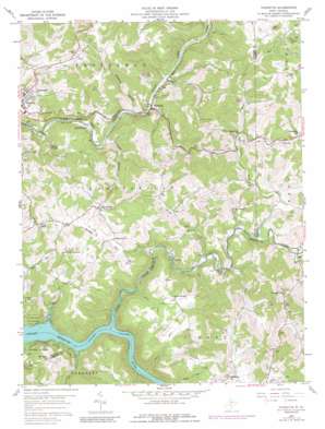
Thornton Topo Map West Virginia
To zoom in, hover over the map of Thornton
USGS Topo Quad 39079c8 - 1:24,000 scale
| Topo Map Name: | Thornton |
| USGS Topo Quad ID: | 39079c8 |
| Print Size: | ca. 21 1/4" wide x 27" high |
| Southeast Coordinates: | 39.25° N latitude / 79.875° W longitude |
| Map Center Coordinates: | 39.3125° N latitude / 79.9375° W longitude |
| U.S. State: | WV |
| Filename: | o39079c8.jpg |
| Download Map JPG Image: | Thornton topo map 1:24,000 scale |
| Map Type: | Topographic |
| Topo Series: | 7.5´ |
| Map Scale: | 1:24,000 |
| Source of Map Images: | United States Geological Survey (USGS) |
| Alternate Map Versions: |
Thornton WV 1958, updated 1960 Download PDF Buy paper map Thornton WV 1958, updated 1974 Download PDF Buy paper map Thornton WV 1958, updated 1977 Download PDF Buy paper map Thornton WV 1958, updated 1989 Download PDF Buy paper map Thornton WV 2011 Download PDF Buy paper map Thornton WV 2014 Download PDF Buy paper map Thornton WV 2016 Download PDF Buy paper map |
1:24,000 Topo Quads surrounding Thornton
> Back to 39079a1 at 1:100,000 scale
> Back to 39078a1 at 1:250,000 scale
> Back to U.S. Topo Maps home
Thornton topo map: Gazetteer
Thornton: Airports
Larew Airport elevation 537m 1761′Roy Airfield elevation 461m 1512′
Thornton: Populated Places
Brownlow elevation 378m 1240′Cecil elevation 353m 1158′
Claude elevation 399m 1309′
Dent elevation 402m 1318′
Eby elevation 428m 1404′
Hiram elevation 390m 1279′
Knottsville elevation 457m 1499′
Lesmalinston elevation 316m 1036′
Loftis (historical) elevation 354m 1161′
Maple Run elevation 403m 1322′
Millertown elevation 445m 1459′
Sandy (historical) elevation 335m 1099′
Thornton elevation 318m 1043′
Westerman (historical) elevation 320m 1049′
Thornton: Post Offices
Thornton Post Office elevation 333m 1092′Thornton: Springs
Albert Veyon Spring elevation 384m 1259′Thornton: Streams
Cove Run elevation 335m 1099′Frog Run elevation 335m 1099′
Glade Run elevation 393m 1289′
Joes Run elevation 355m 1164′
Lick Run elevation 335m 1099′
Little Cove Run elevation 443m 1453′
Little Sandy Creek elevation 396m 1299′
Maple Run elevation 399m 1309′
Oldroad Run elevation 397m 1302′
Rocky Branch elevation 312m 1023′
Sandy Creek elevation 335m 1099′
Swamp Run elevation 381m 1250′
Thornton: Valleys
Siggens Hollow elevation 318m 1043′Thornton digital topo map on disk
Buy this Thornton topo map showing relief, roads, GPS coordinates and other geographical features, as a high-resolution digital map file on DVD:


