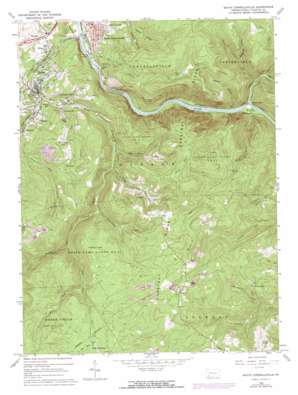
South Connellsville Topo Map Pennsylvania
To zoom in, hover over the map of South Connellsville
USGS Topo Quad 39079h5 - 1:24,000 scale
| Topo Map Name: | South Connellsville |
| USGS Topo Quad ID: | 39079h5 |
| Print Size: | ca. 21 1/4" wide x 27" high |
| Southeast Coordinates: | 39.875° N latitude / 79.5° W longitude |
| Map Center Coordinates: | 39.9375° N latitude / 79.5625° W longitude |
| U.S. State: | PA |
| Filename: | o39079h5.jpg |
| Download Map JPG Image: | South Connellsville topo map 1:24,000 scale |
| Map Type: | Topographic |
| Topo Series: | 7.5´ |
| Map Scale: | 1:24,000 |
| Source of Map Images: | United States Geological Survey (USGS) |
| Alternate Map Versions: |
South Connellsville PA 1964, updated 1966 Download PDF Buy paper map South Connellsville PA 1964, updated 1972 Download PDF Buy paper map South Connellsville PA 1964, updated 1973 Download PDF Buy paper map South Connellsville PA 1964, updated 1973 Download PDF Buy paper map South Connellsville PA 1999, updated 2000 Download PDF Buy paper map South Connellsville PA 2010 Download PDF Buy paper map South Connellsville PA 2013 Download PDF Buy paper map South Connellsville PA 2016 Download PDF Buy paper map |
1:24,000 Topo Quads surrounding South Connellsville
> Back to 39079e1 at 1:100,000 scale
> Back to 39078a1 at 1:250,000 scale
> Back to U.S. Topo Maps home
South Connellsville topo map: Gazetteer
South Connellsville: Dams
Foleys Dam elevation 569m 1866′South Connellsville: Flats
Zebley Flats elevation 643m 2109′South Connellsville: Lakes
McGowans Lake elevation 445m 1459′South Connellsville: Parks
State Game Lands Number 51 elevation 638m 2093′South Connellsville: Populated Places
Bowest elevation 268m 879′Brown Row elevation 323m 1059′
Dunbar elevation 319m 1046′
Factory Hill elevation 366m 1200′
Ferguson elevation 359m 1177′
Furnace Hill elevation 372m 1220′
Hardy Hill elevation 383m 1256′
Indian Creek elevation 304m 997′
Irishtown elevation 534m 1751′
Pechin elevation 345m 1131′
Reservoir Hill elevation 357m 1171′
Sitka elevation 305m 1000′
South Connellsville elevation 320m 1049′
South Connellsville: Streams
Blackberry Run elevation 420m 1377′Elk Rock Run elevation 380m 1246′
Flat Rock Run elevation 608m 1994′
Gist Run elevation 306m 1003′
Glade Run elevation 459m 1505′
Indian Creek elevation 286m 938′
Irishtown Run elevation 325m 1066′
Laurel Run elevation 279m 915′
Limestone Run elevation 437m 1433′
Morgan Run elevation 289m 948′
Richter Run elevation 303m 994′
Rock Run elevation 512m 1679′
Tates Run elevation 298m 977′
Tucker Run elevation 390m 1279′
South Connellsville: Summits
Elk Rock elevation 694m 2276′Holland Hill elevation 534m 1751′
Tharp Knob elevation 580m 1902′
South Connellsville: Valleys
Indian Creek Gorge elevation 286m 938′Johns Hollow elevation 553m 1814′
McManas Hollow elevation 392m 1286′
South Connellsville digital topo map on disk
Buy this South Connellsville topo map showing relief, roads, GPS coordinates and other geographical features, as a high-resolution digital map file on DVD:


