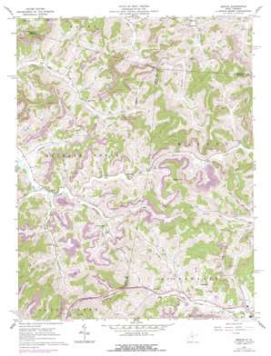
Berlin Topo Map West Virginia
To zoom in, hover over the map of Berlin
USGS Topo Quad 39080a3 - 1:24,000 scale
| Topo Map Name: | Berlin |
| USGS Topo Quad ID: | 39080a3 |
| Print Size: | ca. 21 1/4" wide x 27" high |
| Southeast Coordinates: | 39° N latitude / 80.25° W longitude |
| Map Center Coordinates: | 39.0625° N latitude / 80.3125° W longitude |
| U.S. State: | WV |
| Filename: | o39080a3.jpg |
| Download Map JPG Image: | Berlin topo map 1:24,000 scale |
| Map Type: | Topographic |
| Topo Series: | 7.5´ |
| Map Scale: | 1:24,000 |
| Source of Map Images: | United States Geological Survey (USGS) |
| Alternate Map Versions: |
Berlin WV 1961, updated 1962 Download PDF Buy paper map Berlin WV 1961, updated 1977 Download PDF Buy paper map Berlin WV 2011 Download PDF Buy paper map Berlin WV 2014 Download PDF Buy paper map Berlin WV 2016 Download PDF Buy paper map |
1:24,000 Topo Quads surrounding Berlin
> Back to 39080a1 at 1:100,000 scale
> Back to 39080a1 at 1:250,000 scale
> Back to U.S. Topo Maps home
Berlin topo map: Gazetteer
Berlin: Populated Places
Aberdeen elevation 348m 1141′Berlin elevation 326m 1069′
Johnstown elevation 331m 1085′
Lorentz elevation 441m 1446′
Red Rock elevation 441m 1446′
White Oak elevation 333m 1092′
Berlin: Streams
Bills Lick elevation 322m 1056′Bloody Run elevation 314m 1030′
Bridge Run elevation 437m 1433′
Buckhannon Run elevation 316m 1036′
Bull Lick elevation 328m 1076′
Frog Run elevation 324m 1062′
Laurel Lick elevation 314m 1030′
Mud Lick elevation 431m 1414′
Sauls Run elevation 441m 1446′
Wash Run elevation 436m 1430′
Berlin: Summits
Bear Knob elevation 570m 1870′Berlin digital topo map on disk
Buy this Berlin topo map showing relief, roads, GPS coordinates and other geographical features, as a high-resolution digital map file on DVD:


