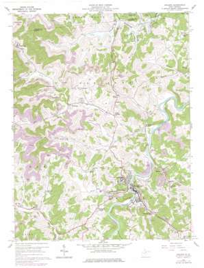
Philippi Topo Map West Virginia
To zoom in, hover over the map of Philippi
USGS Topo Quad 39080b1 - 1:24,000 scale
| Topo Map Name: | Philippi |
| USGS Topo Quad ID: | 39080b1 |
| Print Size: | ca. 21 1/4" wide x 27" high |
| Southeast Coordinates: | 39.125° N latitude / 80° W longitude |
| Map Center Coordinates: | 39.1875° N latitude / 80.0625° W longitude |
| U.S. State: | WV |
| Filename: | o39080b1.jpg |
| Download Map JPG Image: | Philippi topo map 1:24,000 scale |
| Map Type: | Topographic |
| Topo Series: | 7.5´ |
| Map Scale: | 1:24,000 |
| Source of Map Images: | United States Geological Survey (USGS) |
| Alternate Map Versions: |
Philippi WV 1960, updated 1961 Download PDF Buy paper map Philippi WV 1960, updated 1970 Download PDF Buy paper map Philippi WV 1960, updated 1978 Download PDF Buy paper map Philippi WV 2011 Download PDF Buy paper map Philippi WV 2014 Download PDF Buy paper map Philippi WV 2016 Download PDF Buy paper map |
1:24,000 Topo Quads surrounding Philippi
> Back to 39080a1 at 1:100,000 scale
> Back to 39080a1 at 1:250,000 scale
> Back to U.S. Topo Maps home
Philippi topo map: Gazetteer
Philippi: Airports
Philippi Airport elevation 524m 1719′Philippi: Bridges
Philippi Covered Bridge elevation 392m 1286′Philippi: Parks
Blue and Gray Park elevation 396m 1299′Dayton Park elevation 409m 1341′
Memorial Park elevation 392m 1286′
Philippi Historic District elevation 399m 1309′
Pleasant Creek Wildlife Management Area elevation 349m 1145′
Philippi: Populated Places
Adaland elevation 426m 1397′Berryburg elevation 412m 1351′
Berryburg Junction elevation 413m 1354′
Boylen (historical) elevation 404m 1325′
Corder Crossing elevation 414m 1358′
Elk City elevation 331m 1085′
Fox Hall (historical) elevation 398m 1305′
Galloway elevation 327m 1072′
Hopewell elevation 423m 1387′
Mansfield elevation 431m 1414′
Meriden elevation 398m 1305′
Midlan (historical) elevation 394m 1292′
Philippi elevation 397m 1302′
Pleasant Creek (historical) elevation 344m 1128′
Tygart Glen elevation 397m 1302′
Wellington Heights elevation 452m 1482′
Philippi: Post Offices
Philippi Post Office elevation 398m 1305′Philippi: Springs
L C McDaniels Spring elevation 460m 1509′Pleasant Creek Spring elevation 356m 1167′
Philippi: Streams
Anglins Run elevation 392m 1286′Bartlett Run elevation 344m 1128′
Camp Run elevation 335m 1099′
Fords Run elevation 392m 1286′
Foxgrape Run elevation 392m 1286′
Hackers Creek elevation 393m 1289′
Little Hackers Creek elevation 397m 1302′
Little Laurel Run elevation 395m 1295′
Rockcamp Run elevation 392m 1286′
Shooks Run elevation 396m 1299′
Spaw Lick elevation 329m 1079′
Taylor Drain elevation 391m 1282′
Philippi: Summits
King Knob elevation 601m 1971′Philippi digital topo map on disk
Buy this Philippi topo map showing relief, roads, GPS coordinates and other geographical features, as a high-resolution digital map file on DVD:


