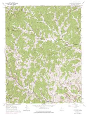
Wallace Topo Map West Virginia
To zoom in, hover over the map of Wallace
USGS Topo Quad 39080d4 - 1:24,000 scale
| Topo Map Name: | Wallace |
| USGS Topo Quad ID: | 39080d4 |
| Print Size: | ca. 21 1/4" wide x 27" high |
| Southeast Coordinates: | 39.375° N latitude / 80.375° W longitude |
| Map Center Coordinates: | 39.4375° N latitude / 80.4375° W longitude |
| U.S. State: | WV |
| Filename: | o39080d4.jpg |
| Download Map JPG Image: | Wallace topo map 1:24,000 scale |
| Map Type: | Topographic |
| Topo Series: | 7.5´ |
| Map Scale: | 1:24,000 |
| Source of Map Images: | United States Geological Survey (USGS) |
| Alternate Map Versions: |
Wallace WV 1960, updated 1963 Download PDF Buy paper map Wallace WV 1960, updated 1978 Download PDF Buy paper map Wallace WV 2011 Download PDF Buy paper map Wallace WV 2014 Download PDF Buy paper map Wallace WV 2016 Download PDF Buy paper map |
1:24,000 Topo Quads surrounding Wallace
> Back to 39080a1 at 1:100,000 scale
> Back to 39080a1 at 1:250,000 scale
> Back to U.S. Topo Maps home
Wallace topo map: Gazetteer
Wallace: Dams
Nolan Run Slurry Impoundment Dam elevation 350m 1148′Robinson Run Mine Number 95 W S Dam elevation 359m 1177′
Wallace: Populated Places
Alliance elevation 339m 1112′Big Run elevation 321m 1053′
Brown elevation 321m 1053′
Dola elevation 294m 964′
Grangeville elevation 308m 1010′
Jimtown elevation 303m 994′
Joetown elevation 310m 1017′
Margaret elevation 320m 1049′
Mount Tabor elevation 327m 1072′
Oakdale elevation 303m 994′
Wallace elevation 313m 1026′
Wallace: Reservoirs
Mine 95 Water Supply Reservoir elevation 359m 1177′Nolan Run Slurry Impoundment elevation 350m 1148′
Wallace: Streams
Barnes Run elevation 316m 1036′Bennett Run elevation 293m 961′
Big Elk Creek elevation 306m 1003′
Big Indian Run elevation 301m 987′
Big Run elevation 295m 967′
Caldwell Run elevation 294m 964′
Camp Run elevation 303m 994′
Coal Lick Run elevation 304m 997′
Crabapple Run elevation 307m 1007′
Glade Fork elevation 304m 997′
Goose Run elevation 317m 1040′
Harris Fork elevation 312m 1023′
Jake Run elevation 302m 990′
Laurel Run elevation 298m 977′
Left Fork Big Elk Creek elevation 321m 1053′
Little Elk Creek elevation 303m 994′
Little Indian Run elevation 298m 977′
Little Run elevation 314m 1030′
Little Run elevation 314m 1030′
Long Fork elevation 308m 1010′
Middle Run elevation 309m 1013′
Mill Run elevation 302m 990′
Painter Fork elevation 319m 1046′
Price Fork elevation 285m 935′
Quaker Fork elevation 312m 1023′
Right Fork Big Elk Creek elevation 321m 1053′
Road Fork elevation 316m 1036′
Shinn Run elevation 306m 1003′
Shinn Run elevation 314m 1030′
Tucker Fork elevation 316m 1036′
Wolfpit Run elevation 319m 1046′
Wallace: Valleys
Baker Hollow elevation 317m 1040′Neely Hollow elevation 328m 1076′
Rogers Hollow elevation 316m 1036′
Wallace digital topo map on disk
Buy this Wallace topo map showing relief, roads, GPS coordinates and other geographical features, as a high-resolution digital map file on DVD:


