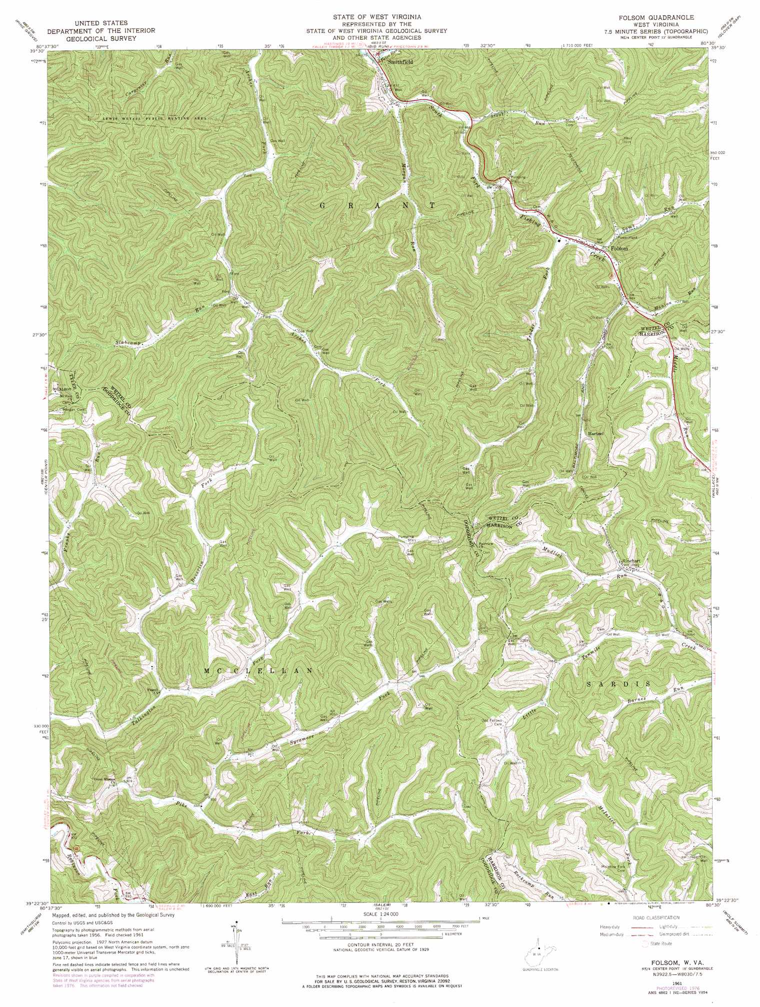
Folsom Topo Map West Virginia
To zoom in, hover over the map of Folsom
USGS Topo Quad 39080d5 - 1:24,000 scale
| Topo Map Name: | Folsom |
| USGS Topo Quad ID: | 39080d5 |
| Print Size: | ca. 21 1/4" wide x 27" high |
| Southeast Coordinates: | 39.375° N latitude / 80.5° W longitude |
| Map Center Coordinates: | 39.4375° N latitude / 80.5625° W longitude |
| U.S. State: | WV |
| Filename: | o39080d5.jpg |
| Download Map JPG Image: | Folsom topo map 1:24,000 scale |
| Map Type: | Topographic |
| Topo Series: | 7.5´ |
| Map Scale: | 1:24,000 |
| Source of Map Images: | United States Geological Survey (USGS) |
| Alternate Map Versions: |
Folsom WV 1961, updated 1963 Download PDF Buy paper map Folsom WV 1961, updated 1977 Download PDF Buy paper map Folsom WV 2011 Download PDF Buy paper map Folsom WV 2014 Download PDF Buy paper map Folsom WV 2016 Download PDF Buy paper map |
1:24,000 Topo Quads surrounding Folsom
New Martinsville |
Wileyville |
Littleton |
Hundred |
Wadestown |
Porters Falls |
Pine Grove |
Big Run |
Glover Gap |
Mannington |
Shirley |
Center Point |
Folsom |
Wallace |
Shinnston |
West Union |
Smithburg |
Salem |
Wolf Summit |
Clarksburg |
Oxford |
New Milton |
Big Isaac |
West Milford |
Mount Clare |
> Back to 39080a1 at 1:100,000 scale
> Back to 39080a1 at 1:250,000 scale
> Back to U.S. Topo Maps home
Folsom topo map: Gazetteer
Folsom: Populated Places
Folsom elevation 282m 925′Hartzel elevation 324m 1062′
Rinehart elevation 326m 1069′
Smithfield elevation 258m 846′
Folsom: Post Offices
Folsom Post Office elevation 280m 918′Folsom: Streams
Beverlin Fork elevation 252m 826′Manion Run elevation 290m 951′
Morgan Run elevation 257m 843′
Mudlick Run elevation 313m 1026′
Price Run elevation 255m 836′
Sams Run elevation 285m 935′
Slabcamp Run elevation 271m 889′
Stout Run elevation 262m 859′
Sycamore Fork elevation 253m 830′
Trader Fork elevation 274m 898′
Folsom digital topo map on disk
Buy this Folsom topo map showing relief, roads, GPS coordinates and other geographical features, as a high-resolution digital map file on DVD:
 map DVD")