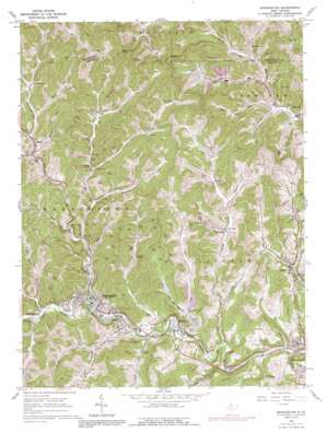
Mannington Topo Map West Virginia
To zoom in, hover over the map of Mannington
USGS Topo Quad 39080e3 - 1:24,000 scale
| Topo Map Name: | Mannington |
| USGS Topo Quad ID: | 39080e3 |
| Print Size: | ca. 21 1/4" wide x 27" high |
| Southeast Coordinates: | 39.5° N latitude / 80.25° W longitude |
| Map Center Coordinates: | 39.5625° N latitude / 80.3125° W longitude |
| U.S. State: | WV |
| Filename: | o39080e3.jpg |
| Download Map JPG Image: | Mannington topo map 1:24,000 scale |
| Map Type: | Topographic |
| Topo Series: | 7.5´ |
| Map Scale: | 1:24,000 |
| Source of Map Images: | United States Geological Survey (USGS) |
| Alternate Map Versions: |
Mannington WV 1960, updated 1962 Download PDF Buy paper map Mannington WV 1960, updated 1978 Download PDF Buy paper map Mannington WV 1960, updated 1991 Download PDF Buy paper map Mannington WV 2011 Download PDF Buy paper map Mannington WV 2014 Download PDF Buy paper map Mannington WV 2016 Download PDF Buy paper map |
1:24,000 Topo Quads surrounding Mannington
> Back to 39080e1 at 1:100,000 scale
> Back to 39080a1 at 1:250,000 scale
> Back to U.S. Topo Maps home
Mannington topo map: Gazetteer
Mannington: Dams
Consol Number Nine Freshwater Dam elevation 321m 1053′Loveridge Fresh Water Dam Number One elevation 356m 1167′
Loveridge Fresh Water Dam Number Three elevation 378m 1240′
Loveridge Fresh Water Dam Number Two elevation 378m 1240′
Loveridge Number Five Dam elevation 331m 1085′
Loveridge Number Four Dam elevation 400m 1312′
Loveridge Slurry Impoundment Dam elevation 391m 1282′
Mannington Dam elevation 298m 977′
Mod Run Impoundment Dam elevation 426m 1397′
Rachel H and F Club Dam elevation 293m 961′
Mannington: Parks
Hough Park elevation 296m 971′Mannington: Populated Places
Condit elevation 307m 1007′Consol Number 9 elevation 315m 1033′
Downs elevation 303m 994′
Flyblow (historical) elevation 436m 1430′
Homewood elevation 312m 1023′
Mannington elevation 297m 974′
McClellan elevation 323m 1059′
Metz elevation 305m 1000′
Rachel elevation 292m 958′
Mannington: Post Offices
Mannington Post Office elevation 296m 971′Metz Post Office elevation 307m 1007′
Rachel Post Office elevation 291m 954′
Mannington: Reservoirs
Consol Number Nine Water Supply Lake elevation 321m 1053′Dents Run Reservoir elevation 298m 977′
Loveridge Freshwater Dam Number One elevation 400m 1312′
Loveridge Mine Impoundment Number Five elevation 331m 1085′
Loveridge Mine Slurry Impoundment elevation 391m 1282′
Mod Run Slurry Pond elevation 426m 1397′
Mannington: Springs
Broadwater Spring elevation 369m 1210′Jamison Number 9 Mine Camp Spring elevation 363m 1190′
John Gump Spring elevation 332m 1089′
Rachel Spring elevation 347m 1138′
Rachel Spring elevation 297m 974′
Mannington: Streams
Brush Run elevation 299m 980′Campbell Run elevation 305m 1000′
Carberry Run elevation 299m 980′
Clear Drain elevation 298m 977′
Dents Run elevation 296m 971′
Drakes Run elevation 304m 997′
Dudley Fork elevation 307m 1007′
East Run elevation 289m 948′
Flaggy Meadow Run elevation 294m 964′
Flat Run elevation 298m 977′
Fleming Fork elevation 311m 1020′
Glade Run elevation 308m 1010′
Grays Run elevation 287m 941′
Harvey Run elevation 316m 1036′
Johnnycake Run elevation 304m 997′
Laurel Run elevation 282m 925′
Left Fork Campbell Run elevation 313m 1026′
Little Dents Run elevation 299m 980′
Little Dunkard Mill Run elevation 308m 1010′
Little Mod Run elevation 315m 1033′
Little Whetstone Run elevation 305m 1000′
Llewellyn Run elevation 301m 987′
Mahan Run elevation 294m 964′
Messer Run elevation 307m 1007′
Mod Run elevation 292m 958′
Plum Run elevation 285m 935′
Pyles Fork elevation 293m 961′
Salt Lick Run elevation 294m 964′
State Road Fork elevation 305m 1000′
State Road Run elevation 308m 1010′
Sugar Run elevation 312m 1023′
Whetstone Run elevation 296m 971′
Mannington: Summits
Bake Oven Knob elevation 505m 1656′Mannington digital topo map on disk
Buy this Mannington topo map showing relief, roads, GPS coordinates and other geographical features, as a high-resolution digital map file on DVD:


