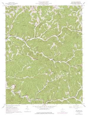
Big Run Topo Map West Virginia
To zoom in, hover over the map of Big Run
USGS Topo Quad 39080e5 - 1:24,000 scale
| Topo Map Name: | Big Run |
| USGS Topo Quad ID: | 39080e5 |
| Print Size: | ca. 21 1/4" wide x 27" high |
| Southeast Coordinates: | 39.5° N latitude / 80.5° W longitude |
| Map Center Coordinates: | 39.5625° N latitude / 80.5625° W longitude |
| U.S. State: | WV |
| Filename: | o39080e5.jpg |
| Download Map JPG Image: | Big Run topo map 1:24,000 scale |
| Map Type: | Topographic |
| Topo Series: | 7.5´ |
| Map Scale: | 1:24,000 |
| Source of Map Images: | United States Geological Survey (USGS) |
| Alternate Map Versions: |
Big Run WV 1960, updated 1962 Download PDF Buy paper map Big Run WV 1960, updated 1977 Download PDF Buy paper map Big Run WV 2011 Download PDF Buy paper map Big Run WV 2014 Download PDF Buy paper map Big Run WV 2016 Download PDF Buy paper map |
1:24,000 Topo Quads surrounding Big Run
> Back to 39080e1 at 1:100,000 scale
> Back to 39080a1 at 1:250,000 scale
> Back to U.S. Topo Maps home
Big Run topo map: Gazetteer
Big Run: Populated Places
Archer elevation 249m 816′Bane elevation 253m 830′
Big Run elevation 249m 816′
Burchfield elevation 261m 856′
Coburn elevation 298m 977′
Fairview elevation 463m 1519′
Four Mile elevation 243m 797′
Hazel elevation 303m 994′
Kingstown elevation 246m 807′
Kodol elevation 350m 1148′
Mobley elevation 270m 885′
Pricetown elevation 273m 895′
Sincerity elevation 418m 1371′
Big Run: Post Offices
Big Run Post Office elevation 250m 820′Big Run: Ridges
Anderson Ridge elevation 456m 1496′Creswell Ridge elevation 455m 1492′
Gilbert Ridge elevation 491m 1610′
Lowman Ridge elevation 459m 1505′
Big Run: Streams
Arches Fork elevation 247m 810′Ashcamp Run elevation 239m 784′
Aunty Run elevation 244m 800′
Bear Run elevation 256m 839′
Big Run elevation 249m 816′
Buck Run elevation 267m 875′
Carpenter Run elevation 242m 793′
Fallen Timber Run elevation 248m 813′
Fourmile Run elevation 237m 777′
Garrison Fork elevation 248m 813′
Glade Fork elevation 278m 912′
Haymond Run elevation 261m 856′
Merrifield Run elevation 256m 839′
Mobley Run elevation 266m 872′
Morgan Run elevation 296m 971′
North Fork Richwood Run elevation 257m 843′
Pickenpaw Run elevation 270m 885′
Raccoon Run elevation 279m 915′
Rockcamp Run elevation 249m 816′
Sheep Run elevation 234m 767′
Slip Run elevation 269m 882′
Tenmile Run elevation 278m 912′
Wiley Fork elevation 280m 918′
Willey Fork elevation 243m 797′
Big Run: Valleys
Miller Hollow elevation 266m 872′Big Run digital topo map on disk
Buy this Big Run topo map showing relief, roads, GPS coordinates and other geographical features, as a high-resolution digital map file on DVD:


