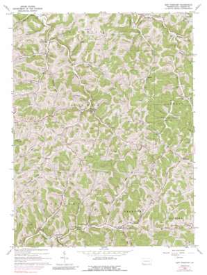
New Freeport Topo Map Pennsylvania
To zoom in, hover over the map of New Freeport
USGS Topo Quad 39080g4 - 1:24,000 scale
| Topo Map Name: | New Freeport |
| USGS Topo Quad ID: | 39080g4 |
| Print Size: | ca. 21 1/4" wide x 27" high |
| Southeast Coordinates: | 39.75° N latitude / 80.375° W longitude |
| Map Center Coordinates: | 39.8125° N latitude / 80.4375° W longitude |
| U.S. State: | PA |
| Filename: | o39080g4.jpg |
| Download Map JPG Image: | New Freeport topo map 1:24,000 scale |
| Map Type: | Topographic |
| Topo Series: | 7.5´ |
| Map Scale: | 1:24,000 |
| Source of Map Images: | United States Geological Survey (USGS) |
| Alternate Map Versions: |
New Freeport PA 1964, updated 1965 Download PDF Buy paper map New Freeport PA 1964, updated 1973 Download PDF Buy paper map New Freeport PA 1964, updated 1989 Download PDF Buy paper map New Freeport PA 2010 Download PDF Buy paper map New Freeport PA 2013 Download PDF Buy paper map New Freeport PA 2016 Download PDF Buy paper map |
1:24,000 Topo Quads surrounding New Freeport
> Back to 39080e1 at 1:100,000 scale
> Back to 39080a1 at 1:250,000 scale
> Back to U.S. Topo Maps home
New Freeport topo map: Gazetteer
New Freeport: Parks
State Game Lands Number 179 elevation 378m 1240′New Freeport: Populated Places
Aleppo elevation 324m 1062′Bristoria elevation 312m 1023′
Deep Valley elevation 310m 1017′
Delphene elevation 337m 1105′
Higbee elevation 362m 1187′
McCracken elevation 305m 1000′
Morford elevation 426m 1397′
Nettle Hill elevation 454m 1489′
New Freeport elevation 324m 1062′
Riggs elevation 341m 1118′
Windy Gap elevation 440m 1443′
New Freeport: Post Offices
Highbee Post Office (historical) elevation 379m 1243′New Freeport: Ridges
Mount Carmel Ridge elevation 462m 1515′New Freeport: Streams
Barneys Run elevation 289m 948′Bissett Run elevation 309m 1013′
Blacks Creek elevation 306m 1003′
Chambers Run elevation 317m 1040′
Cook Run elevation 319m 1046′
Falling Timber Run elevation 323m 1059′
Hamilton Run elevation 322m 1056′
Herod Run elevation 326m 1069′
Hewitt Run elevation 297m 974′
Hewitt Run elevation 304m 997′
Job Creek elevation 319m 1046′
Laurel Run elevation 312m 1023′
Long Run elevation 304m 997′
Mudlick Fork elevation 299m 980′
Wagonroad Run elevation 305m 1000′
Webster Run elevation 320m 1049′
Whitethorn Run elevation 321m 1053′
New Freeport: Valleys
Monkey Hollow elevation 318m 1043′Strawn Hollow elevation 293m 961′
New Freeport digital topo map on disk
Buy this New Freeport topo map showing relief, roads, GPS coordinates and other geographical features, as a high-resolution digital map file on DVD:


