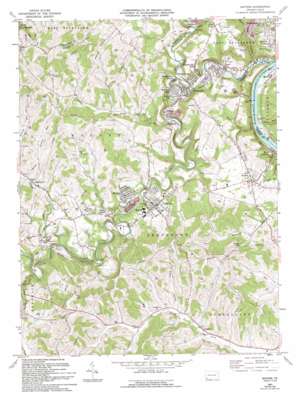
Mather Topo Map Pennsylvania
To zoom in, hover over the map of Mather
USGS Topo Quad 39080h1 - 1:24,000 scale
| Topo Map Name: | Mather |
| USGS Topo Quad ID: | 39080h1 |
| Print Size: | ca. 21 1/4" wide x 27" high |
| Southeast Coordinates: | 39.875° N latitude / 80° W longitude |
| Map Center Coordinates: | 39.9375° N latitude / 80.0625° W longitude |
| U.S. State: | PA |
| Filename: | o39080h1.jpg |
| Download Map JPG Image: | Mather topo map 1:24,000 scale |
| Map Type: | Topographic |
| Topo Series: | 7.5´ |
| Map Scale: | 1:24,000 |
| Source of Map Images: | United States Geological Survey (USGS) |
| Alternate Map Versions: |
Mather PA 1961, updated 1963 Download PDF Buy paper map Mather PA 1961, updated 1973 Download PDF Buy paper map Mather PA 1961, updated 1994 Download PDF Buy paper map Mather PA 2010 Download PDF Buy paper map Mather PA 2013 Download PDF Buy paper map Mather PA 2016 Download PDF Buy paper map |
1:24,000 Topo Quads surrounding Mather
> Back to 39080e1 at 1:100,000 scale
> Back to 39080a1 at 1:250,000 scale
> Back to U.S. Topo Maps home
Mather topo map: Gazetteer
Mather: Dams
Browns Run Dam elevation 282m 925′Mather: Mines
Browns Run Portal elevation 328m 1076′Clyde 3 Portal elevation 327m 1072′
Edwards Shaft Portal elevation 246m 807′
Emerald Mine elevation 258m 846′
Mather: Parks
Pumpkin Run County Park elevation 279m 915′Mather: Populated Places
Besco elevation 254m 833′Braden Plan elevation 277m 908′
Burson Plan elevation 247m 810′
Chartiers elevation 305m 1000′
Clarksville elevation 245m 803′
Clarksville Hill elevation 291m 954′
Dry Tavern elevation 305m 1000′
Jefferson elevation 293m 961′
Khedive elevation 311m 1020′
Lippincott elevation 291m 954′
Mather elevation 291m 954′
Milfred Terrace elevation 309m 1013′
Pitt Gas elevation 261m 856′
Sandy Plains elevation 360m 1181′
Stony Point elevation 299m 980′
Teagarden Homes elevation 267m 875′
Williamstown elevation 256m 839′
Mather: Reservoirs
Browns Run Reservoir elevation 282m 925′Shady Lake elevation 320m 1049′
Mather: Streams
Bacon Run elevation 285m 935′Bates Run elevation 240m 787′
Browns Run elevation 262m 859′
Castile Run elevation 250m 820′
Coal Lick Run elevation 274m 898′
Grimes Run elevation 296m 971′
Pumpkin Run elevation 238m 780′
Ruff Creek elevation 272m 892′
Rush Run elevation 259m 849′
South Branch Muddy Creek elevation 311m 1020′
South Fork Tenmile Creek elevation 237m 777′
Mather: Tunnels
Wayne Tunnel elevation 325m 1066′Mather: Valleys
Black Dog Hollow elevation 256m 839′Eaton Hollow elevation 309m 1013′
Mather digital topo map on disk
Buy this Mather topo map showing relief, roads, GPS coordinates and other geographical features, as a high-resolution digital map file on DVD:


