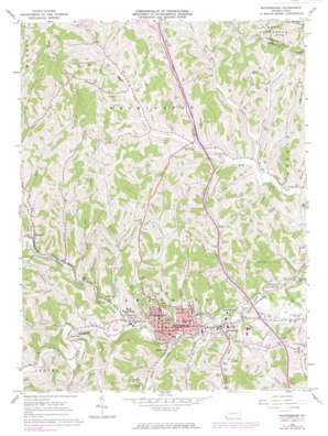
Waynesburg Topo Map Pennsylvania
To zoom in, hover over the map of Waynesburg
USGS Topo Quad 39080h2 - 1:24,000 scale
| Topo Map Name: | Waynesburg |
| USGS Topo Quad ID: | 39080h2 |
| Print Size: | ca. 21 1/4" wide x 27" high |
| Southeast Coordinates: | 39.875° N latitude / 80.125° W longitude |
| Map Center Coordinates: | 39.9375° N latitude / 80.1875° W longitude |
| U.S. State: | PA |
| Filename: | o39080h2.jpg |
| Download Map JPG Image: | Waynesburg topo map 1:24,000 scale |
| Map Type: | Topographic |
| Topo Series: | 7.5´ |
| Map Scale: | 1:24,000 |
| Source of Map Images: | United States Geological Survey (USGS) |
| Alternate Map Versions: |
Waynesburg PA 1961, updated 1963 Download PDF Buy paper map Waynesburg PA 1961, updated 1970 Download PDF Buy paper map Waynesburg PA 1961, updated 1973 Download PDF Buy paper map Waynesburg PA 1961, updated 1980 Download PDF Buy paper map Waynesburg PA 2010 Download PDF Buy paper map Waynesburg PA 2013 Download PDF Buy paper map Waynesburg PA 2016 Download PDF Buy paper map |
1:24,000 Topo Quads surrounding Waynesburg
> Back to 39080e1 at 1:100,000 scale
> Back to 39080a1 at 1:250,000 scale
> Back to U.S. Topo Maps home
Waynesburg topo map: Gazetteer
Waynesburg: Airports
Greene County Airport elevation 335m 1099′Waynesburg: Dams
Waynesburg Water Company Dam elevation 332m 1089′Waynesburg: Mines
Grimes Portal elevation 305m 1000′Waynesburg: Parks
College Field elevation 285m 935′Emerald Ball Park elevation 288m 944′
Veterans Memorial Plaza elevation 345m 1131′
Waynesburg: Populated Places
Blairtown elevation 290m 951′Castile elevation 401m 1315′
East View elevation 294m 964′
Morrisville elevation 298m 977′
Rees Mill elevation 294m 964′
Ruff Creek elevation 299m 980′
Sycamore elevation 302m 990′
Waynesburg elevation 296m 971′
West Waynesburg elevation 303m 994′
Waynesburg: Reservoirs
Waynesburg Water Company Reservoir elevation 332m 1089′Waynesburg: Streams
Bates Fork elevation 297m 974′Boyd Run elevation 312m 1023′
Browns Creek elevation 283m 928′
Clear Run elevation 292m 958′
Craig Run elevation 299m 980′
Craynes Run elevation 295m 967′
Garners Run elevation 294m 964′
Grimes Run elevation 290m 951′
Jackson Run elevation 292m 958′
Jersey Run elevation 297m 974′
Laurel Run elevation 297m 974′
Mud Lick Run elevation 286m 938′
Pettit Run elevation 297m 974′
Poverty Run elevation 294m 964′
Purman Run elevation 290m 951′
Pursley Creek elevation 288m 944′
Rush Run elevation 286m 938′
Smith Creek elevation 289m 948′
Sugar Run elevation 289m 948′
Throckmorton Run elevation 294m 964′
Toll Gate Run elevation 287m 941′
Walkers Run elevation 316m 1036′
Wisecarver Run elevation 291m 954′
Waynesburg: Valleys
Dark Hollow elevation 315m 1033′Waynesburg digital topo map on disk
Buy this Waynesburg topo map showing relief, roads, GPS coordinates and other geographical features, as a high-resolution digital map file on DVD:


