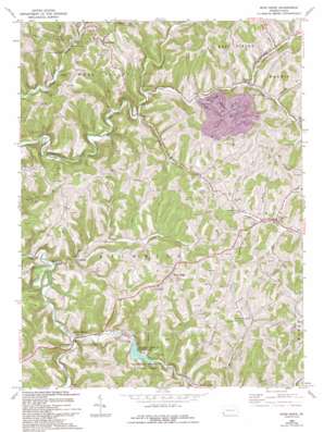
Wind Ridge Topo Map Pennsylvania
To zoom in, hover over the map of Wind Ridge
USGS Topo Quad 39080h4 - 1:24,000 scale
| Topo Map Name: | Wind Ridge |
| USGS Topo Quad ID: | 39080h4 |
| Print Size: | ca. 21 1/4" wide x 27" high |
| Southeast Coordinates: | 39.875° N latitude / 80.375° W longitude |
| Map Center Coordinates: | 39.9375° N latitude / 80.4375° W longitude |
| U.S. State: | PA |
| Filename: | o39080h4.jpg |
| Download Map JPG Image: | Wind Ridge topo map 1:24,000 scale |
| Map Type: | Topographic |
| Topo Series: | 7.5´ |
| Map Scale: | 1:24,000 |
| Source of Map Images: | United States Geological Survey (USGS) |
| Alternate Map Versions: |
Wind Ridge PA 1964, updated 1965 Download PDF Buy paper map Wind Ridge PA 1964, updated 1973 Download PDF Buy paper map Wind Ridge PA 1964, updated 1994 Download PDF Buy paper map Wind Ridge PA 1997, updated 1999 Download PDF Buy paper map Wind Ridge PA 2010 Download PDF Buy paper map Wind Ridge PA 2013 Download PDF Buy paper map Wind Ridge PA 2016 Download PDF Buy paper map |
1:24,000 Topo Quads surrounding Wind Ridge
> Back to 39080e1 at 1:100,000 scale
> Back to 39080a1 at 1:250,000 scale
> Back to U.S. Topo Maps home
Wind Ridge topo map: Gazetteer
Wind Ridge: Dams
Ryerson Station State Park Dam elevation 292m 958′Wind Ridge: Parks
Ryerson Station State Park elevation 365m 1197′State Game Lands Number 302 elevation 416m 1364′
Wind Ridge: Populated Places
Bryan elevation 294m 964′Burdette elevation 291m 954′
Crabapple elevation 287m 941′
Durbin elevation 273m 895′
Enon elevation 302m 990′
Graysville elevation 350m 1148′
Nebo elevation 429m 1407′
Ryerson Station elevation 296m 971′
Simpson Store elevation 318m 1043′
West Finley elevation 428m 1404′
Wind Ridge elevation 437m 1433′
Wind Ridge: Reservoirs
Ryerson Station Reservoir elevation 292m 958′Wind Ridge: Streams
Beham Run elevation 284m 931′Boothe Run elevation 325m 1066′
Crabapple Creek elevation 272m 892′
Fletcher Run elevation 353m 1158′
Grinnage Run elevation 335m 1099′
Kent Run elevation 296m 971′
Long Run elevation 321m 1053′
North Fork Dunkard Fork elevation 280m 918′
Owens Run elevation 289m 948′
Polen Run elevation 302m 990′
Rocky Run elevation 304m 997′
South Fork Dunkard Fork elevation 280m 918′
Templeton Fork elevation 289m 948′
Wind Ridge: Valleys
Polly Hollow elevation 300m 984′Zimmerman Hollow elevation 339m 1112′
Wind Ridge digital topo map on disk
Buy this Wind Ridge topo map showing relief, roads, GPS coordinates and other geographical features, as a high-resolution digital map file on DVD:


