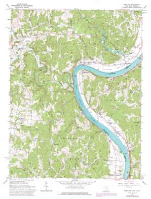
Portland Topo Map Ohio
To zoom in, hover over the map of Portland
USGS Topo Quad 39081a7 - 1:24,000 scale
| Topo Map Name: | Portland |
| USGS Topo Quad ID: | 39081a7 |
| Print Size: | ca. 21 1/4" wide x 27" high |
| Southeast Coordinates: | 39° N latitude / 81.75° W longitude |
| Map Center Coordinates: | 39.0625° N latitude / 81.8125° W longitude |
| U.S. States: | OH, WV |
| Filename: | o39081a7.jpg |
| Download Map JPG Image: | Portland topo map 1:24,000 scale |
| Map Type: | Topographic |
| Topo Series: | 7.5´ |
| Map Scale: | 1:24,000 |
| Source of Map Images: | United States Geological Survey (USGS) |
| Alternate Map Versions: |
Portland OH 1960, updated 1963 Download PDF Buy paper map Portland OH 1960, updated 1973 Download PDF Buy paper map Portland OH 1960, updated 1978 Download PDF Buy paper map Portland OH 1960, updated 1978 Download PDF Buy paper map Portland OH 1960, updated 1978 Download PDF Buy paper map Portland OH 1994, updated 1998 Download PDF Buy paper map Portland OH 2010 Download PDF Buy paper map Portland OH 2013 Download PDF Buy paper map Portland OH 2016 Download PDF Buy paper map |
1:24,000 Topo Quads surrounding Portland
> Back to 39081a1 at 1:100,000 scale
> Back to 39080a1 at 1:250,000 scale
> Back to U.S. Topo Maps home
Portland topo map: Gazetteer
Portland: Airports
Bellville Dam Landing Strip elevation 179m 587′Portland: Bends
Long Bottom elevation 180m 590′Muses Bottom elevation 178m 583′
Portland: Dams
Forked Run Lake Dam elevation 183m 600′Lock and Dam Number 21 (historical) elevation 172m 564′
Portland: Flats
Sterling Bottom elevation 187m 613′Portland: Parks
Buffington Island State Memorial elevation 189m 620′Forked Run State Park elevation 211m 692′
Portland: Populated Places
Bald Knobs elevation 245m 803′Bashan elevation 225m 738′
Elden (historical) elevation 224m 734′
Fayal (historical) elevation 232m 761′
Hazael elevation 177m 580′
Keno elevation 182m 597′
Lone Cedar elevation 185m 606′
Long Bottom elevation 183m 600′
Merritt elevation 269m 882′
Morgan elevation 182m 597′
Murraysville elevation 180m 590′
Neptune elevation 175m 574′
Polk elevation 179m 587′
Portland elevation 187m 613′
Runkle (historical) elevation 179m 587′
Rushville elevation 259m 849′
Shade River elevation 175m 574′
Skull Run elevation 184m 603′
Stiversville elevation 204m 669′
Portland: Post Offices
Bashan Post Office (historical) elevation 225m 738′Elden Post Office (historical) elevation 240m 787′
Fayal Post Office (historical) elevation 231m 757′
Hazael Post Office (historical) elevation 180m 590′
Keno Post Office (historical) elevation 182m 597′
Long Bottom Post Office elevation 182m 597′
Merritt Post Office (historical) elevation 274m 898′
Portland Post Office elevation 187m 613′
Portland: Reservoirs
Forked Run Lake elevation 183m 600′Shade Valley Lake elevation 183m 600′
Portland: Ridges
Bigley Ridge elevation 254m 833′Buck Ridge elevation 267m 875′
Durst Ridge elevation 238m 780′
McKenzie Ridge elevation 267m 875′
Milhoan Ridge elevation 291m 954′
Rainbow Ridge elevation 238m 780′
Portland: Streams
Barney Fork elevation 182m 597′Big Run elevation 175m 574′
Buck Run elevation 176m 577′
Bull Run elevation 171m 561′
DeWitt Run elevation 175m 574′
East Branch Shade River elevation 176m 577′
Forked Run elevation 171m 561′
Guyan Run elevation 174m 570′
Laucks Run elevation 172m 564′
Lickskillet Run elevation 178m 583′
Little Forked Run elevation 171m 561′
Long Run elevation 172m 564′
Perry Run elevation 175m 574′
Robison Run elevation 172m 564′
Rock Run elevation 172m 564′
Ross Run elevation 192m 629′
Shade River elevation 172m 564′
Skull Run elevation 172m 564′
Spicer Creek elevation 176m 577′
Spruce Creek elevation 179m 587′
Trouble Creek elevation 187m 613′
Turben Creek elevation 189m 620′
Washington Run elevation 172m 564′
Wells Run elevation 173m 567′
Wheaton Run elevation 172m 564′
Withered Run elevation 181m 593′
Portland: Summits
Peach Knob elevation 230m 754′Portland: Trails
Riverview Trail elevation 234m 767′Portland: Valleys
Bacon Hollow elevation 180m 590′Bone Hollow elevation 176m 577′
Wildcat Hollow elevation 192m 629′
Portland digital topo map on disk
Buy this Portland topo map showing relief, roads, GPS coordinates and other geographical features, as a high-resolution digital map file on DVD:


