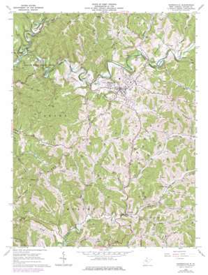
Harrisville Topo Map West Virginia
To zoom in, hover over the map of Harrisville
USGS Topo Quad 39081b1 - 1:24,000 scale
| Topo Map Name: | Harrisville |
| USGS Topo Quad ID: | 39081b1 |
| Print Size: | ca. 21 1/4" wide x 27" high |
| Southeast Coordinates: | 39.125° N latitude / 81° W longitude |
| Map Center Coordinates: | 39.1875° N latitude / 81.0625° W longitude |
| U.S. State: | WV |
| Filename: | o39081b1.jpg |
| Download Map JPG Image: | Harrisville topo map 1:24,000 scale |
| Map Type: | Topographic |
| Topo Series: | 7.5´ |
| Map Scale: | 1:24,000 |
| Source of Map Images: | United States Geological Survey (USGS) |
| Alternate Map Versions: |
Harrisville WV 1964, updated 1966 Download PDF Buy paper map Harrisville WV 1964, updated 1977 Download PDF Buy paper map Harrisville WV 1964, updated 1984 Download PDF Buy paper map Harrisville WV 2010 Download PDF Buy paper map Harrisville WV 2014 Download PDF Buy paper map Harrisville WV 2016 Download PDF Buy paper map |
1:24,000 Topo Quads surrounding Harrisville
> Back to 39081a1 at 1:100,000 scale
> Back to 39080a1 at 1:250,000 scale
> Back to U.S. Topo Maps home
Harrisville topo map: Gazetteer
Harrisville: Dams
Harrisville City Reservoir Dam elevation 217m 711′North Bend Golf Course Area Lake Dam elevation 250m 820′
Harrisville: Parks
North Bend State Park elevation 263m 862′Harrisville: Populated Places
Chevaux De Frise elevation 256m 839′Cokeleys elevation 349m 1145′
Cornwallis elevation 205m 672′
Hannahdale elevation 225m 738′
Harrisville elevation 261m 856′
Hartley elevation 347m 1138′
Star Settlement (historical) elevation 252m 826′
Washburn elevation 229m 751′
Harrisville: Post Offices
Cokeleys Post Office (historical) elevation 328m 1076′Washburn Post Office (historical) elevation 232m 761′
Harrisville: Ridges
Hulderman Ridge elevation 338m 1108′Union Ridge elevation 353m 1158′
Victory Ridge elevation 305m 1000′
Harrisville: Streams
Adds Run elevation 249m 816′Back Run elevation 217m 711′
Bear Run elevation 204m 669′
Bearwallow Run elevation 259m 849′
Bonds Creek elevation 213m 698′
Bridge Run elevation 219m 718′
Bunnell Run elevation 222m 728′
Camp Run elevation 212m 695′
Chevaux de Frise Run elevation 229m 751′
Coffield Run elevation 249m 816′
Cunningham Run elevation 218m 715′
Davy Cain Run elevation 232m 761′
Den Run elevation 246m 807′
Dog Run elevation 222m 728′
Goose Run elevation 221m 725′
Hushers Run elevation 210m 688′
Indian Run elevation 221m 725′
King Knob Run elevation 220m 721′
Lost Run elevation 217m 711′
Moyers Run elevation 236m 774′
Rockcamp Run elevation 219m 718′
Stewart Run elevation 218m 715′
Third Run elevation 218m 715′
Twolick Run elevation 242m 793′
White Oak Run elevation 226m 741′
Harrisville: Summits
King Knob elevation 386m 1266′Vesper Knoll elevation 327m 1072′
Harrisville digital topo map on disk
Buy this Harrisville topo map showing relief, roads, GPS coordinates and other geographical features, as a high-resolution digital map file on DVD:


