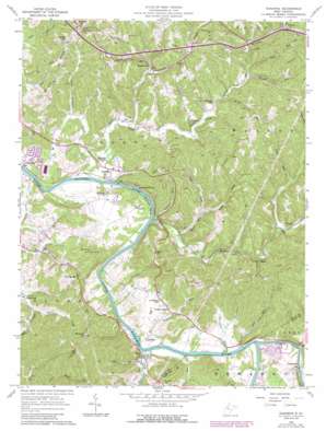
Kanawha Topo Map West Virginia
To zoom in, hover over the map of Kanawha
USGS Topo Quad 39081b4 - 1:24,000 scale
| Topo Map Name: | Kanawha |
| USGS Topo Quad ID: | 39081b4 |
| Print Size: | ca. 21 1/4" wide x 27" high |
| Southeast Coordinates: | 39.125° N latitude / 81.375° W longitude |
| Map Center Coordinates: | 39.1875° N latitude / 81.4375° W longitude |
| U.S. State: | WV |
| Filename: | o39081b4.jpg |
| Download Map JPG Image: | Kanawha topo map 1:24,000 scale |
| Map Type: | Topographic |
| Topo Series: | 7.5´ |
| Map Scale: | 1:24,000 |
| Source of Map Images: | United States Geological Survey (USGS) |
| Alternate Map Versions: |
Kanawha WV 1957, updated 1958 Download PDF Buy paper map Kanawha WV 1957, updated 1974 Download PDF Buy paper map Kanawha WV 1957, updated 1976 Download PDF Buy paper map Kanawha WV 1957, updated 1989 Download PDF Buy paper map Kanawha WV 2010 Download PDF Buy paper map Kanawha WV 2014 Download PDF Buy paper map Kanawha WV 2016 Download PDF Buy paper map |
1:24,000 Topo Quads surrounding Kanawha
> Back to 39081a1 at 1:100,000 scale
> Back to 39080a1 at 1:250,000 scale
> Back to U.S. Topo Maps home
Kanawha topo map: Gazetteer
Kanawha: Bends
Butcher Bend elevation 182m 597′Kanawha: Crossings
Pecks Ford elevation 178m 583′Kanawha: Dams
A and O Farms Dam elevation 229m 751′Kanawha: Populated Places
Chesterville elevation 196m 643′Community Acres elevation 194m 636′
Cool Springs elevation 233m 764′
Dallison elevation 211m 692′
Davisville elevation 189m 620′
Greencastle elevation 191m 626′
Hanna elevation 192m 629′
Hughs Subdivision elevation 196m 643′
Kanawha elevation 194m 636′
Leachtown elevation 194m 636′
Murphytown elevation 198m 649′
Red Hill elevation 284m 931′
Slate elevation 192m 629′
Valley View Acres elevation 250m 820′
Walker elevation 190m 623′
Weekleys (historical) elevation 201m 659′
Kanawha: Post Offices
Walker Post Office elevation 190m 623′Kanawha: Ridges
Dutch Ridge elevation 269m 882′Kanawha: Streams
Allen Run elevation 179m 587′Beeson Run elevation 198m 649′
Camp Run elevation 200m 656′
Cow Run elevation 183m 600′
Daley Run elevation 183m 600′
Fall Run elevation 178m 583′
Hannaman Run elevation 178m 583′
Hughes River elevation 178m 583′
Kites Run elevation 179m 587′
Left Fork Kites Run elevation 190m 623′
Left Fork Stillwell Creek elevation 183m 600′
Little Stillwell Creek elevation 179m 587′
Lost Run elevation 200m 656′
Millseat Run elevation 192m 629′
Negro Run elevation 183m 600′
North Fork Stillwell Creek elevation 213m 698′
Right Fork Kites Run elevation 190m 623′
Rock Run elevation 192m 629′
Slate Creek elevation 185m 606′
Stillwell Creek elevation 179m 587′
Tug Fork elevation 188m 616′
Tunnel Run elevation 182m 597′
Walker Creek elevation 181m 593′
West Fork Creek elevation 202m 662′
Kanawha: Summits
Butcher Hill elevation 278m 912′McKusic Hill elevation 325m 1066′
Red Hill elevation 312m 1023′
Kanawha digital topo map on disk
Buy this Kanawha topo map showing relief, roads, GPS coordinates and other geographical features, as a high-resolution digital map file on DVD:


