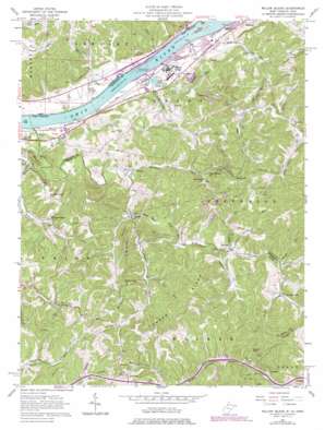
Willow Island Topo Map West Virginia
To zoom in, hover over the map of Willow Island
USGS Topo Quad 39081c3 - 1:24,000 scale
| Topo Map Name: | Willow Island |
| USGS Topo Quad ID: | 39081c3 |
| Print Size: | ca. 21 1/4" wide x 27" high |
| Southeast Coordinates: | 39.25° N latitude / 81.25° W longitude |
| Map Center Coordinates: | 39.3125° N latitude / 81.3125° W longitude |
| U.S. States: | WV, OH |
| Filename: | o39081c3.jpg |
| Download Map JPG Image: | Willow Island topo map 1:24,000 scale |
| Map Type: | Topographic |
| Topo Series: | 7.5´ |
| Map Scale: | 1:24,000 |
| Source of Map Images: | United States Geological Survey (USGS) |
| Alternate Map Versions: |
Willow Island WV 1957, updated 1958 Download PDF Buy paper map Willow Island WV 1957, updated 1967 Download PDF Buy paper map Willow Island WV 1957, updated 1977 Download PDF Buy paper map Willow Island WV 1976, updated 1979 Download PDF Buy paper map Willow Island WV 1994, updated 1998 Download PDF Buy paper map Willow Island WV 2002, updated 2006 Download PDF Buy paper map Willow Island WV 2011 Download PDF Buy paper map Willow Island WV 2014 Download PDF Buy paper map Willow Island WV 2016 Download PDF Buy paper map |
| FStopo: | US Forest Service topo Willow Island is available: Download FStopo PDF Download FStopo TIF |
1:24,000 Topo Quads surrounding Willow Island
> Back to 39081a1 at 1:100,000 scale
> Back to 39080a1 at 1:250,000 scale
> Back to U.S. Topo Maps home
Willow Island topo map: Gazetteer
Willow Island: Dams
Mcelroys Run Embankment Dam elevation 290m 951′Willow Island Locks and Dam elevation 184m 603′
Willow Island Locks and Dam elevation 183m 600′
Willow Island: Islands
Eureka Island elevation 187m 613′Willow Island: Parks
Sand Hill Wildlife Management Area elevation 373m 1223′Willow Island: Populated Places
Borland elevation 209m 685′Cluster elevation 190m 623′
Corbin (historical) elevation 302m 990′
Deerwalk elevation 282m 925′
Eureka elevation 197m 646′
Horseneck elevation 248m 813′
Lower Newport elevation 192m 629′
Newlandsville elevation 234m 767′
Sandhill elevation 333m 1092′
Willow Island elevation 195m 639′
Willow Island: Post Offices
Willow Island Post Office elevation 197m 646′Willow Island: Ridges
Hannan Ridge elevation 326m 1069′Middle Ridge elevation 293m 961′
Willow Island: Streams
Allen Run elevation 185m 606′Atward Run elevation 206m 675′
Bull Creek elevation 182m 597′
Bull Run elevation 179m 587′
Burns Run elevation 184m 603′
Calf Creek elevation 179m 587′
Campbell Run elevation 204m 669′
Clay Lick Run elevation 205m 672′
Cow Creek elevation 186m 610′
Feeny Run elevation 204m 669′
Gough Run elevation 221m 725′
Horseneck Run elevation 186m 610′
Isaacs Fork elevation 192m 629′
Laurel Fork elevation 230m 754′
Limestone Run elevation 211m 692′
Old Road Run elevation 192m 629′
Pickens Run elevation 199m 652′
Plummers Creek elevation 182m 597′
Right Fork Bull Creek elevation 191m 626′
Robins Run elevation 187m 613′
Rush Run elevation 197m 646′
Sheets Run elevation 180m 590′
Sled Run elevation 198m 649′
Sulphur Spring Run elevation 206m 675′
Willow Island: Summits
Buzzard Rocks elevation 388m 1272′Willow Island: Valleys
Polecat Hollow elevation 183m 600′Willow Island digital topo map on disk
Buy this Willow Island topo map showing relief, roads, GPS coordinates and other geographical features, as a high-resolution digital map file on DVD:


