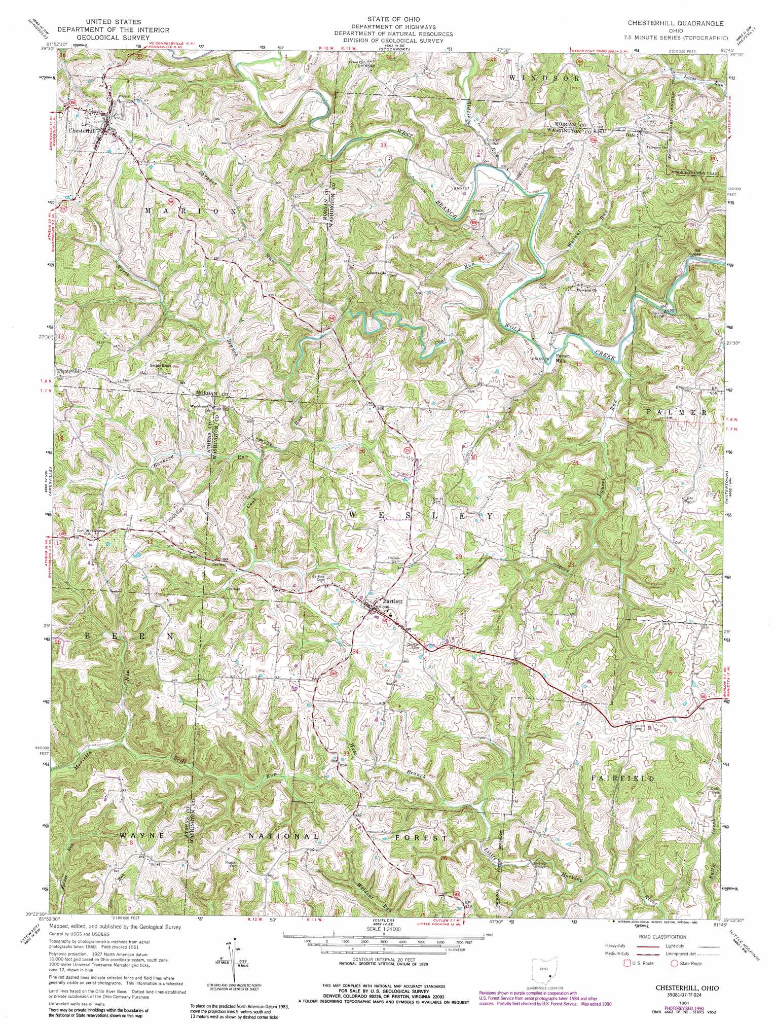
Chesterhill Topo Map Ohio
To zoom in, hover over the map of Chesterhill
USGS Topo Quad 39081d7 - 1:24,000 scale
| Topo Map Name: | Chesterhill |
| USGS Topo Quad ID: | 39081d7 |
| Print Size: | ca. 21 1/4" wide x 27" high |
| Southeast Coordinates: | 39.375° N latitude / 81.75° W longitude |
| Map Center Coordinates: | 39.4375° N latitude / 81.8125° W longitude |
| U.S. State: | OH |
| Filename: | o39081d7.jpg |
| Download Map JPG Image: | Chesterhill topo map 1:24,000 scale |
| Map Type: | Topographic |
| Topo Series: | 7.5´ |
| Map Scale: | 1:24,000 |
| Source of Map Images: | United States Geological Survey (USGS) |
| Alternate Map Versions: |
Chesterhill OH 1961, updated 1962 Download PDF Buy paper map Chesterhill OH 1961, updated 1973 Download PDF Buy paper map Chesterhill OH 1961, updated 1984 Download PDF Buy paper map Chesterhill OH 1961, updated 1990 Download PDF Buy paper map Chesterhill OH 1994, updated 1998 Download PDF Buy paper map Chesterhill OH 2002, updated 2006 Download PDF Buy paper map Chesterhill OH 2011 Download PDF Buy paper map Chesterhill OH 2013 Download PDF Buy paper map Chesterhill OH 2016 Download PDF Buy paper map |
| FStopo: | US Forest Service topo Chesterhill is available: Download FStopo PDF Download FStopo TIF |
1:24,000 Topo Quads surrounding Chesterhill
Deavertown |
Rokeby Lock |
Mcconnelsville |
Reinersville |
Caldwell South |
Corning |
Ringgold |
Stockport |
Beverly |
Lowell |
Jacksonville |
Amesville |
Chesterhill |
Watertown |
Fleming |
Athens |
Stewart |
Cutler |
Little Hocking |
Parkersburg |
Shade |
Alfred |
Coolville |
Lubeck |
South Parkersburg |
> Back to 39081a1 at 1:100,000 scale
> Back to 39080a1 at 1:250,000 scale
> Back to U.S. Topo Maps home
Chesterhill topo map: Gazetteer
Chesterhill: Bridges
Henry Bridge elevation 212m 695′Shinn Bridge elevation 209m 685′
Chesterhill: Parks
Downtown Chesterhill Historic District elevation 298m 977′Chesterhill: Populated Places
Bartlett elevation 268m 879′Chesterhill elevation 297m 974′
Dale elevation 295m 967′
Patten Mills elevation 210m 688′
Chesterhill: Post Offices
Chesterhill Post Office elevation 292m 958′Chesterhill: Streams
Aldridge Run elevation 216m 708′Brill Run elevation 208m 682′
Buckeye Run elevation 229m 751′
Coal Run elevation 210m 688′
Laurel Run elevation 209m 685′
Mile Run elevation 235m 770′
North Branch Coal Run elevation 226m 741′
Shrader Run elevation 221m 725′
Walnut Run elevation 210m 688′
Chesterhill digital topo map on disk
Buy this Chesterhill topo map showing relief, roads, GPS coordinates and other geographical features, as a high-resolution digital map file on DVD:
 map DVD")