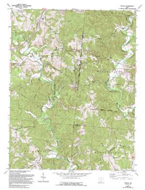
Mulga Topo Map Ohio
To zoom in, hover over the map of Mulga
USGS Topo Quad 39082a4 - 1:24,000 scale
| Topo Map Name: | Mulga |
| USGS Topo Quad ID: | 39082a4 |
| Print Size: | ca. 21 1/4" wide x 27" high |
| Southeast Coordinates: | 39° N latitude / 82.375° W longitude |
| Map Center Coordinates: | 39.0625° N latitude / 82.4375° W longitude |
| U.S. State: | OH |
| Filename: | o39082a4.jpg |
| Download Map JPG Image: | Mulga topo map 1:24,000 scale |
| Map Type: | Topographic |
| Topo Series: | 7.5´ |
| Map Scale: | 1:24,000 |
| Source of Map Images: | United States Geological Survey (USGS) |
| Alternate Map Versions: |
Mulga OH 1961, updated 1963 Download PDF Buy paper map Mulga OH 1961, updated 1968 Download PDF Buy paper map Mulga OH 1961, updated 1977 Download PDF Buy paper map Mulga OH 1961, updated 1985 Download PDF Buy paper map Mulga OH 1961, updated 1995 Download PDF Buy paper map Mulga OH 2010 Download PDF Buy paper map Mulga OH 2013 Download PDF Buy paper map Mulga OH 2016 Download PDF Buy paper map |
1:24,000 Topo Quads surrounding Mulga
> Back to 39082a1 at 1:100,000 scale
> Back to 39082a1 at 1:250,000 scale
> Back to U.S. Topo Maps home
Mulga topo map: Gazetteer
Mulga: Bridges
Buckeye Furnace Bridge elevation 200m 656′Ponn Humpback Covered Bridge elevation 188m 616′
Mulga: Parks
Buckeye Furnace State Memorial elevation 196m 643′Mulga: Populated Places
Buckeye elevation 196m 643′Clarion elevation 201m 659′
Hawks elevation 195m 639′
Keystone elevation 194m 636′
Minerton elevation 189m 620′
Mulga elevation 205m 672′
Pattonsville elevation 245m 803′
Wainwright elevation 205m 672′
Mulga: Ridges
Hothouse Ridge elevation 282m 925′Mulga: Streams
Buffer Run elevation 195m 639′Coal Run elevation 196m 643′
Dickason Run elevation 191m 626′
Dixon Run elevation 192m 629′
Flint Run elevation 195m 639′
Goose Run elevation 192m 629′
Greasy Run elevation 195m 639′
Indiancamp Run elevation 187m 613′
Karr Run elevation 189m 620′
Kyger Run elevation 190m 623′
Mulga Run elevation 201m 659′
Rich Run elevation 197m 646′
Rockcamp Run elevation 188m 616′
Tarcamp Run elevation 194m 636′
Mulga digital topo map on disk
Buy this Mulga topo map showing relief, roads, GPS coordinates and other geographical features, as a high-resolution digital map file on DVD:


