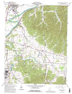
Waverly South Topo Map Ohio
To zoom in, hover over the map of Waverly South
USGS Topo Quad 39082a8 - 1:24,000 scale
| Topo Map Name: | Waverly South |
| USGS Topo Quad ID: | 39082a8 |
| Print Size: | ca. 21 1/4" wide x 27" high |
| Southeast Coordinates: | 39° N latitude / 82.875° W longitude |
| Map Center Coordinates: | 39.0625° N latitude / 82.9375° W longitude |
| U.S. State: | OH |
| Filename: | o39082a8.jpg |
| Download Map JPG Image: | Waverly South topo map 1:24,000 scale |
| Map Type: | Topographic |
| Topo Series: | 7.5´ |
| Map Scale: | 1:24,000 |
| Source of Map Images: | United States Geological Survey (USGS) |
| Alternate Map Versions: |
Waverly South OH 1961, updated 1963 Download PDF Buy paper map Waverly South OH 1961, updated 1972 Download PDF Buy paper map Waverly South OH 1961, updated 1979 Download PDF Buy paper map Waverly South OH 1961, updated 1985 Download PDF Buy paper map Waverly South OH 1992, updated 1995 Download PDF Buy paper map Waverly South OH 2010 Download PDF Buy paper map Waverly South OH 2013 Download PDF Buy paper map Waverly South OH 2016 Download PDF Buy paper map |
1:24,000 Topo Quads surrounding Waverly South
> Back to 39082a1 at 1:100,000 scale
> Back to 39082a1 at 1:250,000 scale
> Back to U.S. Topo Maps home
Waverly South topo map: Gazetteer
Waverly South: Dams
Atomic Energy Commission Dam elevation 203m 666′Atomic Energy Commission Pond Dam elevation 209m 685′
Pine Lake Dam elevation 188m 616′
Waverly South: Populated Places
Beaver Pike Estates elevation 201m 659′Bobo elevation 198m 649′
Germany elevation 199m 652′
Givens elevation 201m 659′
Glen Jean elevation 173m 567′
Green Acres elevation 175m 574′
Greggs elevation 196m 643′
Greggs Hill elevation 186m 610′
Rehm elevation 203m 666′
Robbins (historical) elevation 204m 669′
Shyville elevation 219m 718′
Waverly Place elevation 212m 695′
Zahns Corners elevation 202m 662′
Waverly South: Post Offices
Bobo Post Office (historical) elevation 200m 656′Germany Post Office (historical) elevation 198m 649′
Given Post Office (historical) elevation 201m 659′
Shyville Post Office (historical) elevation 219m 718′
Waverly South: Reservoirs
Atomic Energy Commission Lake elevation 203m 666′Atomic Energy Commission Pond elevation 209m 685′
Pine Lake elevation 188m 616′
Waverly South: Streams
Dutch Run elevation 194m 636′Fivemile Creek elevation 185m 606′
Fourmile Creek elevation 183m 600′
Marcus Run elevation 168m 551′
Millers Run elevation 183m 600′
Millstone Run elevation 189m 620′
Pecks Creek elevation 183m 600′
Pee Pee Creek elevation 162m 531′
Straight Creek elevation 180m 590′
Waverly South: Summits
Pine Knob elevation 321m 1053′Sand Hill elevation 330m 1082′
Waverly South: Valleys
Bandy Hollow elevation 198m 649′Dog Hollow elevation 186m 610′
Givens Hollow elevation 199m 652′
Happy Hollow elevation 182m 597′
Jenkins Hollow elevation 203m 666′
Red Hollow elevation 199m 652′
Scratch Hollow elevation 198m 649′
Waverly South digital topo map on disk
Buy this Waverly South topo map showing relief, roads, GPS coordinates and other geographical features, as a high-resolution digital map file on DVD:


