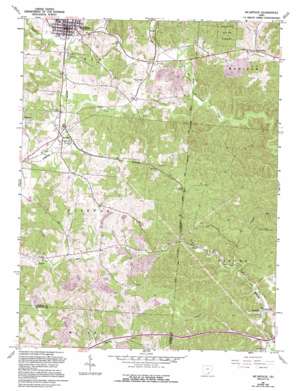
Mcarthur Topo Map Ohio
To zoom in, hover over the map of Mcarthur
USGS Topo Quad 39082b4 - 1:24,000 scale
| Topo Map Name: | Mcarthur |
| USGS Topo Quad ID: | 39082b4 |
| Print Size: | ca. 21 1/4" wide x 27" high |
| Southeast Coordinates: | 39.125° N latitude / 82.375° W longitude |
| Map Center Coordinates: | 39.1875° N latitude / 82.4375° W longitude |
| U.S. State: | OH |
| Filename: | o39082b4.jpg |
| Download Map JPG Image: | Mcarthur topo map 1:24,000 scale |
| Map Type: | Topographic |
| Topo Series: | 7.5´ |
| Map Scale: | 1:24,000 |
| Source of Map Images: | United States Geological Survey (USGS) |
| Alternate Map Versions: |
Mc Arthur OH 1961 Download PDF Buy paper map Mc Arthur OH 1961, updated 1963 Download PDF Buy paper map Mc Arthur OH 1961, updated 1972 Download PDF Buy paper map Mcarthur OH 1961, updated 1985 Download PDF Buy paper map Mcarthur OH 1961, updated 1995 Download PDF Buy paper map McArthur OH 2010 Download PDF Buy paper map McArthur OH 2013 Download PDF Buy paper map McArthur OH 2016 Download PDF Buy paper map |
1:24,000 Topo Quads surrounding Mcarthur
> Back to 39082a1 at 1:100,000 scale
> Back to 39082a1 at 1:250,000 scale
> Back to U.S. Topo Maps home
Mcarthur topo map: Gazetteer
Mcarthur: Forests
Wayne National Forest elevation 246m 807′Mcarthur: Populated Places
Dundas elevation 231m 757′McArthur elevation 233m 764′
Oreton elevation 209m 685′
Prattsville elevation 241m 790′
Puritan elevation 225m 738′
Radcliff elevation 213m 698′
Vinton elevation 211m 692′
Mcarthur: Streams
Puncheon Fork elevation 212m 695′Wolf Run elevation 213m 698′
Mcarthur digital topo map on disk
Buy this Mcarthur topo map showing relief, roads, GPS coordinates and other geographical features, as a high-resolution digital map file on DVD:


