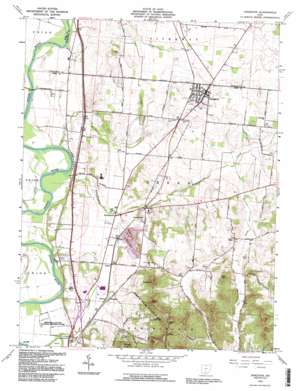
Kingston Topo Map Ohio
To zoom in, hover over the map of Kingston
USGS Topo Quad 39082d8 - 1:24,000 scale
| Topo Map Name: | Kingston |
| USGS Topo Quad ID: | 39082d8 |
| Print Size: | ca. 21 1/4" wide x 27" high |
| Southeast Coordinates: | 39.375° N latitude / 82.875° W longitude |
| Map Center Coordinates: | 39.4375° N latitude / 82.9375° W longitude |
| U.S. State: | OH |
| Filename: | o39082d8.jpg |
| Download Map JPG Image: | Kingston topo map 1:24,000 scale |
| Map Type: | Topographic |
| Topo Series: | 7.5´ |
| Map Scale: | 1:24,000 |
| Source of Map Images: | United States Geological Survey (USGS) |
| Alternate Map Versions: |
Kingston OH 1961, updated 1962 Download PDF Buy paper map Kingston OH 1961, updated 1973 Download PDF Buy paper map Kingston OH 1961, updated 1977 Download PDF Buy paper map Kingston OH 1961, updated 1988 Download PDF Buy paper map Kingston OH 1992, updated 1995 Download PDF Buy paper map Kingston OH 2010 Download PDF Buy paper map Kingston OH 2013 Download PDF Buy paper map Kingston OH 2016 Download PDF Buy paper map |
1:24,000 Topo Quads surrounding Kingston
> Back to 39082a1 at 1:100,000 scale
> Back to 39082a1 at 1:250,000 scale
> Back to U.S. Topo Maps home
Kingston topo map: Gazetteer
Kingston: Airports
Medical Center Hospital Heliport elevation 225m 738′Kingston: Populated Places
Courtright (historical) elevation 222m 728′Delano elevation 213m 698′
Hopetown elevation 199m 652′
Kingston elevation 241m 790′
Kinnikinnick elevation 201m 659′
Metzger elevation 216m 708′
Kingston: Post Offices
Hopetown Post Office (historical) elevation 199m 652′Kingston Post Office elevation 241m 790′
Kinnikinnick Post Office (historical) elevation 201m 659′
Kingston: Streams
Blackwater Creek elevation 190m 623′Kinnikinnick Creek elevation 189m 620′
South Fork Kinnikinnick Creek elevation 217m 711′
Kingston: Summits
Bald Hill elevation 363m 1190′Bunker Hill elevation 384m 1259′
Hays Hill elevation 319m 1046′
Sand Hill elevation 395m 1295′
Sugarloaf elevation 370m 1213′
Kingston digital topo map on disk
Buy this Kingston topo map showing relief, roads, GPS coordinates and other geographical features, as a high-resolution digital map file on DVD:


