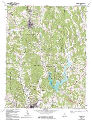
Corning Topo Map Ohio
To zoom in, hover over the map of Corning
USGS Topo Quad 39082e1 - 1:24,000 scale
| Topo Map Name: | Corning |
| USGS Topo Quad ID: | 39082e1 |
| Print Size: | ca. 21 1/4" wide x 27" high |
| Southeast Coordinates: | 39.5° N latitude / 82° W longitude |
| Map Center Coordinates: | 39.5625° N latitude / 82.0625° W longitude |
| U.S. State: | OH |
| Filename: | o39082e1.jpg |
| Download Map JPG Image: | Corning topo map 1:24,000 scale |
| Map Type: | Topographic |
| Topo Series: | 7.5´ |
| Map Scale: | 1:24,000 |
| Source of Map Images: | United States Geological Survey (USGS) |
| Alternate Map Versions: |
Corning OH 1961, updated 1962 Download PDF Buy paper map Corning OH 1961, updated 1971 Download PDF Buy paper map Corning OH 1961, updated 1976 Download PDF Buy paper map Corning OH 1961, updated 1976 Download PDF Buy paper map Corning OH 1961, updated 1995 Download PDF Buy paper map Corning OH 2002, updated 2006 Download PDF Buy paper map Corning OH 2011 Download PDF Buy paper map Corning OH 2013 Download PDF Buy paper map Corning OH 2016 Download PDF Buy paper map |
| FStopo: | US Forest Service topo Corning is available: Download FStopo PDF Download FStopo TIF |
1:24,000 Topo Quads surrounding Corning
> Back to 39082e1 at 1:100,000 scale
> Back to 39082a1 at 1:250,000 scale
> Back to U.S. Topo Maps home
Corning topo map: Gazetteer
Corning: Airports
Burr Oak Lodge Heliport elevation 251m 823′Corning: Bridges
Palos Bridge elevation 208m 682′Corning: Dams
New York Central Reservoir Dam elevation 218m 715′Seimer Pond Dam elevation 225m 738′
Sunday Creek Coal Company Dam 9420-007 Dam elevation 242m 793′
Tom Jenkins Dam elevation 223m 731′
Corning: Parks
Burr Oak State Park elevation 219m 718′Trimble State Wildlife Area elevation 263m 862′
Corning: Populated Places
Bishopville elevation 250m 820′Burr Oak elevation 220m 721′
Chapel Hill elevation 316m 1036′
Congo elevation 270m 885′
Corning elevation 221m 725′
Glouster elevation 207m 679′
Hamburg (historical) elevation 227m 744′
Hartleyville elevation 215m 705′
Hatfield elevation 263m 862′
Hoboken (historical) elevation 215m 705′
Hollister elevation 218m 715′
Hunterdon elevation 223m 731′
McLeish elevation 213m 698′
Millertown elevation 279m 915′
Oakdale elevation 210m 688′
Palos elevation 212m 695′
Rendville elevation 226m 741′
Vicksville elevation 247m 810′
Corning: Post Offices
Bishopville Post Office (historical) elevation 248m 813′Chapel Hill Post Office (historical) elevation 318m 1043′
Congo Post Office (historical) elevation 275m 902′
Corning Post Office elevation 221m 725′
Glouster Post Office elevation 207m 679′
Hartleyville Post Office (historical) elevation 219m 718′
Hollister Post Office (historical) elevation 217m 711′
Oakdale Post Office (historical) elevation 214m 702′
Rendville Post Office elevation 226m 741′
Corning: Reservoirs
Burr Oak Reservoir elevation 223m 731′New York Central Reservoir 9420 elevation 218m 715′
Seimer Pond elevation 225m 738′
Sunday Creek Coal Company Pond 9420-0 elevation 242m 793′
Corning: Ridges
Irish Ridge elevation 303m 994′Spencer Ridge elevation 274m 898′
Corning: Streams
Bloody Run elevation 221m 725′Cedar Run elevation 222m 728′
Dotson Creek elevation 216m 708′
East Branch Sunday Creek elevation 217m 711′
Eels Run elevation 219m 718′
Indian Run elevation 214m 702′
Johnson Run elevation 213m 698′
Long Run elevation 210m 688′
Mud Fork elevation 207m 679′
San Toy Creek elevation 222m 728′
West Branch Sunday Creek elevation 207m 679′
Corning: Trails
Wild Cat Hollow Hiking Trail elevation 232m 761′Corning: Valleys
Glycerin Hollow elevation 216m 708′Happy Hollow elevation 222m 728′
Oakdale Hollow elevation 210m 688′
Wildcat Hollow elevation 235m 770′
Corning digital topo map on disk
Buy this Corning topo map showing relief, roads, GPS coordinates and other geographical features, as a high-resolution digital map file on DVD:


