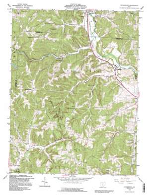
Rockbridge Topo Map Ohio
To zoom in, hover over the map of Rockbridge
USGS Topo Quad 39082e5 - 1:24,000 scale
| Topo Map Name: | Rockbridge |
| USGS Topo Quad ID: | 39082e5 |
| Print Size: | ca. 21 1/4" wide x 27" high |
| Southeast Coordinates: | 39.5° N latitude / 82.5° W longitude |
| Map Center Coordinates: | 39.5625° N latitude / 82.5625° W longitude |
| U.S. State: | OH |
| Filename: | o39082e5.jpg |
| Download Map JPG Image: | Rockbridge topo map 1:24,000 scale |
| Map Type: | Topographic |
| Topo Series: | 7.5´ |
| Map Scale: | 1:24,000 |
| Source of Map Images: | United States Geological Survey (USGS) |
| Alternate Map Versions: |
Rockbridge OH 1961, updated 1963 Download PDF Buy paper map Rockbridge OH 1961, updated 1969 Download PDF Buy paper map Rockbridge OH 1961, updated 1976 Download PDF Buy paper map Rockbridge OH 1992, updated 1995 Download PDF Buy paper map Rockbridge OH 2010 Download PDF Buy paper map Rockbridge OH 2013 Download PDF Buy paper map Rockbridge OH 2016 Download PDF Buy paper map |
1:24,000 Topo Quads surrounding Rockbridge
> Back to 39082e1 at 1:100,000 scale
> Back to 39082a1 at 1:250,000 scale
> Back to U.S. Topo Maps home
Rockbridge topo map: Gazetteer
Rockbridge: Arches
Rockbridge elevation 242m 793′Rockbridge: Bridges
Shade Bridge elevation 251m 823′Rockbridge: Cliffs
Cantwell Cliffs elevation 293m 961′Rockbridge: Dams
Benua Lake Dam elevation 258m 846′Rockbridge: Parks
Clear Creek Nature Preserve elevation 290m 951′Rockbridge: Populated Places
Mound Crossing elevation 258m 846′Pine Grove (historical) elevation 237m 777′
Rockbridge elevation 232m 761′
Rockbridge: Post Offices
Drinkle Post Office (historical) elevation 237m 777′Rockbridge Post Office elevation 232m 761′
Rockbridge: Reservoirs
Benua Lake elevation 258m 846′Rockbridge: Streams
Brushy Fork elevation 231m 757′Buck Run elevation 225m 738′
Clear Creek elevation 231m 757′
Cola Creek elevation 256m 839′
East Branch Buck Run elevation 231m 757′
Jack Run elevation 252m 826′
Little Cola Creek elevation 260m 853′
Rocky Fork elevation 234m 767′
Rush Creek elevation 231m 757′
Rockbridge: Valleys
Toad Hollow elevation 259m 849′Wildcat Hollow elevation 236m 774′
Rockbridge digital topo map on disk
Buy this Rockbridge topo map showing relief, roads, GPS coordinates and other geographical features, as a high-resolution digital map file on DVD:


