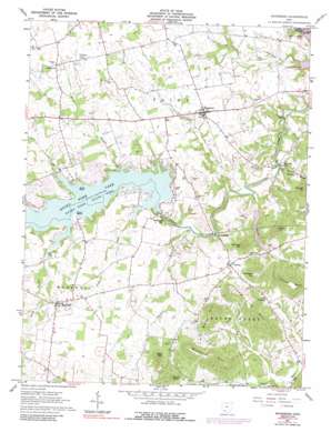
Rainsboro Topo Map Ohio
To zoom in, hover over the map of Rainsboro
USGS Topo Quad 39083b4 - 1:24,000 scale
| Topo Map Name: | Rainsboro |
| USGS Topo Quad ID: | 39083b4 |
| Print Size: | ca. 21 1/4" wide x 27" high |
| Southeast Coordinates: | 39.125° N latitude / 83.375° W longitude |
| Map Center Coordinates: | 39.1875° N latitude / 83.4375° W longitude |
| U.S. State: | OH |
| Filename: | o39083b4.jpg |
| Download Map JPG Image: | Rainsboro topo map 1:24,000 scale |
| Map Type: | Topographic |
| Topo Series: | 7.5´ |
| Map Scale: | 1:24,000 |
| Source of Map Images: | United States Geological Survey (USGS) |
| Alternate Map Versions: |
Rainsboro OH 1961, updated 1962 Download PDF Buy paper map Rainsboro OH 1961, updated 1973 Download PDF Buy paper map Rainsboro OH 1961, updated 1975 Download PDF Buy paper map Rainsboro OH 1961, updated 1988 Download PDF Buy paper map Rainsboro OH 2010 Download PDF Buy paper map Rainsboro OH 2013 Download PDF Buy paper map Rainsboro OH 2016 Download PDF Buy paper map |
1:24,000 Topo Quads surrounding Rainsboro
> Back to 39083a1 at 1:100,000 scale
> Back to 39082a1 at 1:250,000 scale
> Back to U.S. Topo Maps home
Rainsboro topo map: Gazetteer
Rainsboro: Dams
Hickory Hills Lake Dam elevation 268m 879′Rocky Fork Lake Dam elevation 262m 859′
Rainsboro: Parks
Rocky Fork State Park elevation 272m 892′Rainsboro: Populated Places
Barretts Mills elevation 251m 823′Beaver Mill elevation 260m 853′
Carmel elevation 293m 961′
Coon Crossing elevation 305m 1000′
Marshall elevation 317m 1040′
McCoppin Mill elevation 269m 882′
Rainsboro elevation 290m 951′
South Beach elevation 270m 885′
Stringtown elevation 311m 1020′
Rainsboro: Post Offices
Barretts Mills Post Office (historical) elevation 250m 820′Carmel Post Office (historical) elevation 292m 958′
Marshall Post Office (historical) elevation 315m 1033′
Rainsboro Post Office elevation 290m 951′
Rainsboro: Reservoirs
Hickory Hills Lake elevation 268m 879′Paint Creek Lake elevation 232m 761′
Rocky Fork Lake elevation 262m 859′
Rainsboro: Ridges
Long Lick Hill elevation 402m 1318′Washburn Hill elevation 409m 1341′
Rainsboro: Streams
Blinco Branch elevation 274m 898′Churn Creek elevation 272m 892′
Factory Branch elevation 244m 800′
Franklin Branch elevation 251m 823′
Heads Branch elevation 245m 803′
Pickett Run elevation 244m 800′
Plum Run elevation 273m 895′
Puncheon Run elevation 244m 800′
Smith Branch elevation 271m 889′
Rainsboro: Summits
Barrett Hill elevation 382m 1253′Brown Hill elevation 399m 1309′
Brushy Knob elevation 360m 1181′
Heads Hill elevation 372m 1220′
McCoppin Hill elevation 402m 1318′
Slate Hill elevation 385m 1263′
Spargur Hill elevation 372m 1220′
Rainsboro digital topo map on disk
Buy this Rainsboro topo map showing relief, roads, GPS coordinates and other geographical features, as a high-resolution digital map file on DVD:


