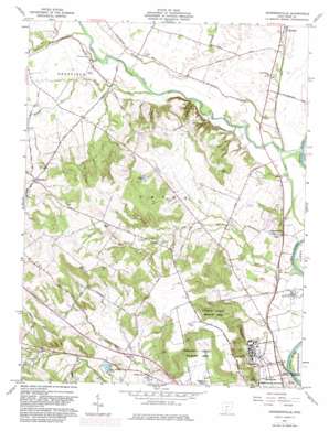
Andersonville Topo Map Ohio
To zoom in, hover over the map of Andersonville
USGS Topo Quad 39083d1 - 1:24,000 scale
| Topo Map Name: | Andersonville |
| USGS Topo Quad ID: | 39083d1 |
| Print Size: | ca. 21 1/4" wide x 27" high |
| Southeast Coordinates: | 39.375° N latitude / 83° W longitude |
| Map Center Coordinates: | 39.4375° N latitude / 83.0625° W longitude |
| U.S. State: | OH |
| Filename: | o39083d1.jpg |
| Download Map JPG Image: | Andersonville topo map 1:24,000 scale |
| Map Type: | Topographic |
| Topo Series: | 7.5´ |
| Map Scale: | 1:24,000 |
| Source of Map Images: | United States Geological Survey (USGS) |
| Alternate Map Versions: |
Andersonville OH 1961, updated 1962 Download PDF Buy paper map Andersonville OH 1961, updated 1962 Download PDF Buy paper map Andersonville OH 1961, updated 1975 Download PDF Buy paper map Andersonville OH 1961, updated 1982 Download PDF Buy paper map Andersonville OH 2010 Download PDF Buy paper map Andersonville OH 2013 Download PDF Buy paper map Andersonville OH 2016 Download PDF Buy paper map |
1:24,000 Topo Quads surrounding Andersonville
> Back to 39083a1 at 1:100,000 scale
> Back to 39082a1 at 1:250,000 scale
> Back to U.S. Topo Maps home
Andersonville topo map: Gazetteer
Andersonville: Airports
Ross County Airport elevation 219m 718′Andersonville: Dams
Rustic Acres Lake Dam elevation 259m 849′Sun Valley Lake Dam elevation 233m 764′
Andersonville: Parks
Pleasant Valley Wildlife Area elevation 240m 787′Andersonville: Pillars
Hopewell Culture National Historical Park elevation 197m 646′Andersonville: Populated Places
Andersonville elevation 198m 649′Brownstown (historical) elevation 216m 708′
Carey elevation 220m 721′
Greenland elevation 254m 833′
View (historical) elevation 292m 958′
Andersonville: Post Offices
Andersonville Post Office (historical) elevation 200m 656′Greenland Post Office (historical) elevation 247m 810′
View Post Office (historical) elevation 293m 961′
Andersonville: Reservoirs
Rustic Acres Lake elevation 259m 849′Sun Valley Lake elevation 233m 764′
Andersonville: Streams
Deer Creek elevation 192m 629′Dry Run elevation 188m 616′
Hay Run elevation 207m 679′
Mad Run elevation 222m 728′
Stall Run elevation 214m 702′
Waugh Run elevation 201m 659′
Andersonville digital topo map on disk
Buy this Andersonville topo map showing relief, roads, GPS coordinates and other geographical features, as a high-resolution digital map file on DVD:


