Jamestown Topo Map Ohio
To zoom in, hover over the map of Jamestown
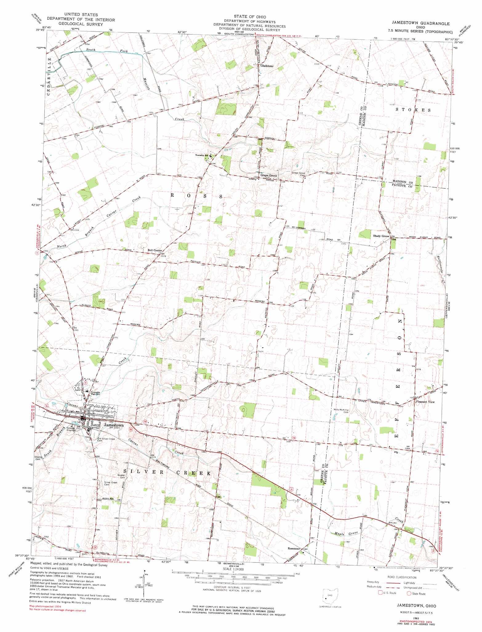
USGS Topo Quad 39083f6 - 1:24,000 scale
| Topo Map Name: | Jamestown |
| USGS Topo Quad ID: | 39083f6 |
| Print Size: | ca. 21 1/4" wide x 27" high |
| Southeast Coordinates: | 39.625° N latitude / 83.625° W longitude |
| Map Center Coordinates: | 39.6875° N latitude / 83.6875° W longitude |
| U.S. State: | OH |
| Filename: | o39083f6.jpg |
| Download Map JPG Image: | Jamestown topo map 1:24,000 scale |
| Map Type: | Topographic |
| Topo Series: | 7.5´ |
| Map Scale: | 1:24,000 |
| Source of Map Images: | United States Geological Survey (USGS) |
| Alternate Map Versions: |
Jamestown OH 1961, updated 1963 Download PDF Buy paper map Jamestown OH 1961, updated 1977 Download PDF Buy paper map Jamestown OH 2010 Download PDF Buy paper map Jamestown OH 2013 Download PDF Buy paper map Jamestown OH 2016 Download PDF Buy paper map |
1:24,000 Topo Quads surrounding Jamestown
Donnelsville |
Springfield |
New Moorefield |
South Vienna |
London |
Yellow Springs |
Clifton |
South Charleston |
Florence |
Walnut Run |
Xenia |
Cedarville |
Jamestown |
Jeffersonville |
Midway |
New Burlington |
Port William |
Bowersville |
Milledgeville |
Washington Court House |
Clarksville |
Wilmington |
Sabina |
Memphis |
New Martinsburg |
> Back to 39083e1 at 1:100,000 scale
> Back to 39082a1 at 1:250,000 scale
> Back to U.S. Topo Maps home
Jamestown topo map: Gazetteer
Jamestown: Airports
Bloom Airport elevation 319m 1046′Camstra Airport elevation 324m 1062′
Velesky Airport elevation 331m 1085′
Jamestown: Populated Places
Gladstone elevation 340m 1115′Grape Grove elevation 334m 1095′
Jamestown elevation 323m 1059′
Mechanicsville (historical) elevation 326m 1069′
Pleasant View elevation 328m 1076′
Rosemoor elevation 325m 1066′
Shady Grove elevation 335m 1099′
Jamestown: Post Offices
Gladstone Post Office (historical) elevation 338m 1108′Grapegrove Post Office (historical) elevation 333m 1092′
Jamestown Post Office elevation 324m 1062′
Jamestown digital topo map on disk
Buy this Jamestown topo map showing relief, roads, GPS coordinates and other geographical features, as a high-resolution digital map file on DVD:
 map DVD")