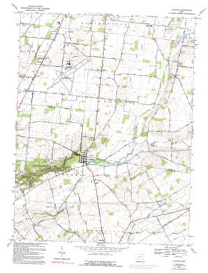
Clifton Topo Map Ohio
To zoom in, hover over the map of Clifton
USGS Topo Quad 39083g7 - 1:24,000 scale
| Topo Map Name: | Clifton |
| USGS Topo Quad ID: | 39083g7 |
| Print Size: | ca. 21 1/4" wide x 27" high |
| Southeast Coordinates: | 39.75° N latitude / 83.75° W longitude |
| Map Center Coordinates: | 39.8125° N latitude / 83.8125° W longitude |
| U.S. State: | OH |
| Filename: | o39083g7.jpg |
| Download Map JPG Image: | Clifton topo map 1:24,000 scale |
| Map Type: | Topographic |
| Topo Series: | 7.5´ |
| Map Scale: | 1:24,000 |
| Source of Map Images: | United States Geological Survey (USGS) |
| Alternate Map Versions: |
Clifton OH 1954, updated 1956 Download PDF Buy paper map Clifton OH 1968, updated 1970 Download PDF Buy paper map Clifton OH 1968, updated 1975 Download PDF Buy paper map Clifton OH 1968, updated 1992 Download PDF Buy paper map Clifton OH 2010 Download PDF Buy paper map Clifton OH 2013 Download PDF Buy paper map Clifton OH 2016 Download PDF Buy paper map |
1:24,000 Topo Quads surrounding Clifton
> Back to 39083e1 at 1:100,000 scale
> Back to 39082a1 at 1:250,000 scale
> Back to U.S. Topo Maps home
Clifton topo map: Gazetteer
Clifton: Airports
Crawley Field elevation 312m 1023′Flying J Airport elevation 327m 1072′
Springfield-Beckley Municipal Airport elevation 318m 1043′
Clifton: Channels
The Narrows elevation 293m 961′Clifton: Lakes
Blue Hole elevation 275m 902′Clifton: Parks
Clifton Gorge State Nature Preserve elevation 269m 882′Grinnell Mill Historic District elevation 296m 971′
Horace Mann Memorial Monument elevation 311m 1020′
John Bryan State Park elevation 310m 1017′
Orton Memorial Monument elevation 304m 997′
Clifton: Pillars
Steamboat Rock elevation 279m 915′Clifton: Populated Places
Clifton elevation 306m 1003′Hustead elevation 315m 1033′
Peacock Acres elevation 312m 1023′
Pitchin elevation 330m 1082′
Clifton: Post Offices
Hustead Post Office (historical) elevation 315m 1033′Pitchin Post Office (historical) elevation 329m 1079′
Clifton: Streams
Goose Creek elevation 307m 1007′North Fork Little Miami River elevation 307m 1007′
Rainbow Run elevation 302m 990′
Clifton: Trails
Arboretum Trail elevation 317m 1040′Orton Memorial Trail elevation 304m 997′
South Gorge Trail elevation 277m 908′
Clifton: Valleys
Clifton Gorge elevation 295m 967′Clifton digital topo map on disk
Buy this Clifton topo map showing relief, roads, GPS coordinates and other geographical features, as a high-resolution digital map file on DVD:


