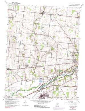
Donnelsville Topo Map Ohio
To zoom in, hover over the map of Donnelsville
USGS Topo Quad 39083h8 - 1:24,000 scale
| Topo Map Name: | Donnelsville |
| USGS Topo Quad ID: | 39083h8 |
| Print Size: | ca. 21 1/4" wide x 27" high |
| Southeast Coordinates: | 39.875° N latitude / 83.875° W longitude |
| Map Center Coordinates: | 39.9375° N latitude / 83.9375° W longitude |
| U.S. State: | OH |
| Filename: | o39083h8.jpg |
| Download Map JPG Image: | Donnelsville topo map 1:24,000 scale |
| Map Type: | Topographic |
| Topo Series: | 7.5´ |
| Map Scale: | 1:24,000 |
| Source of Map Images: | United States Geological Survey (USGS) |
| Alternate Map Versions: |
Donnelsville OH 1955, updated 1956 Download PDF Buy paper map Donnelsville OH 1965, updated 1967 Download PDF Buy paper map Donnelsville OH 1965, updated 1974 Download PDF Buy paper map Donnelsville OH 1965, updated 1990 Download PDF Buy paper map Donnelsville OH 2010 Download PDF Buy paper map Donnelsville OH 2013 Download PDF Buy paper map Donnelsville OH 2016 Download PDF Buy paper map |
1:24,000 Topo Quads surrounding Donnelsville
> Back to 39083e1 at 1:100,000 scale
> Back to 39082a1 at 1:250,000 scale
> Back to U.S. Topo Maps home
Donnelsville topo map: Gazetteer
Donnelsville: Airports
Jenkins Field elevation 330m 1082′Donnelsville: Canals
Minich Ditch elevation 265m 869′Donnelsville: Crossings
Interchange 102B elevation 314m 1030′Interchange 47 elevation 262m 859′
Interchange 48 elevation 268m 879′
Donnelsville: Dams
Hosterman Lake Dam elevation 283m 928′Donnelsville: Parks
Enon Park elevation 265m 869′George Rogers Clark Park elevation 293m 961′
Sturgeon Park elevation 333m 1092′
Donnelsville: Populated Places
Anlo elevation 292m 958′Balentine Acres elevation 329m 1079′
Broadview Acres elevation 313m 1026′
Cedar Hills elevation 324m 1062′
Chateau Estates Mobile Home Park elevation 332m 1089′
Dodo elevation 313m 1026′
Donnelsville elevation 284m 931′
Durbin elevation 268m 879′
Edgewood Mobile Home Park elevation 302m 990′
Enon elevation 274m 898′
Enon Heights Mobile Home Park elevation 300m 984′
Enon Mobile Home Park elevation 274m 898′
Forgy elevation 271m 889′
Hampton Woods elevation 328m 1076′
Karen Woods elevation 312m 1023′
Lawrenceville elevation 339m 1112′
Limestone City elevation 292m 958′
Lindair Acres elevation 308m 1010′
Mad River elevation 265m 869′
North Hampton elevation 333m 1092′
Pleasant Valley Estates Mobile Home Park elevation 271m 889′
Rock Way elevation 314m 1030′
Shrine Road Mobile Home Park elevation 321m 1053′
Snyderville elevation 271m 889′
Sycamore West elevation 308m 1010′
Victoria Villa elevation 321m 1053′
Windy Acres elevation 334m 1095′
Donnelsville: Post Offices
Anlo Post Office (historical) elevation 292m 958′Dodo Post Office (historical) elevation 313m 1026′
Donnelsville Post Office elevation 283m 928′
Enon Post Office elevation 274m 898′
Forgy Post Office (historical) elevation 271m 889′
Lawrenceville Post Office (historical) elevation 338m 1108′
Madriver Post Office (historical) elevation 265m 869′
North Hampton Post Office (historical) elevation 333m 1092′
Snyderville Post Office (historical) elevation 269m 882′
Donnelsville: Reservoirs
Hosterman Lake elevation 283m 928′Donnelsville: Streams
Donnels Creek elevation 262m 859′East Fork Donnels Creek elevation 283m 928′
Jackson Creek elevation 259m 849′
Miller Creek elevation 302m 990′
Donnelsville digital topo map on disk
Buy this Donnelsville topo map showing relief, roads, GPS coordinates and other geographical features, as a high-resolution digital map file on DVD:


