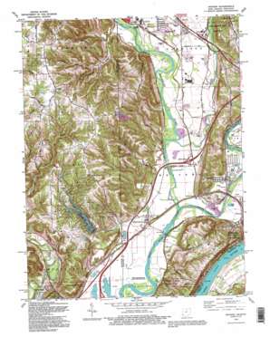
Hooven Topo Map Ohio
To zoom in, hover over the map of Hooven
USGS Topo Quad 39084b7 - 1:24,000 scale
| Topo Map Name: | Hooven |
| USGS Topo Quad ID: | 39084b7 |
| Print Size: | ca. 21 1/4" wide x 27" high |
| Southeast Coordinates: | 39.125° N latitude / 84.75° W longitude |
| Map Center Coordinates: | 39.1875° N latitude / 84.8125° W longitude |
| U.S. States: | OH, KY, IN |
| Filename: | o39084b7.jpg |
| Download Map JPG Image: | Hooven topo map 1:24,000 scale |
| Map Type: | Topographic |
| Topo Series: | 7.5´ |
| Map Scale: | 1:24,000 |
| Source of Map Images: | United States Geological Survey (USGS) |
| Alternate Map Versions: |
Hooven OH 1943 Download PDF Buy paper map Hooven OH 1954, updated 1955 Download PDF Buy paper map Hooven OH 1954, updated 1965 Download PDF Buy paper map Hooven OH 1954, updated 1972 Download PDF Buy paper map Hooven OH 1981, updated 1982 Download PDF Buy paper map Hooven OH 1981, updated 1987 Download PDF Buy paper map Hooven OH 1992, updated 1995 Download PDF Buy paper map Hooven OH 1996, updated 1999 Download PDF Buy paper map Hooven OH 2010 Download PDF Buy paper map Hooven OH 2013 Download PDF Buy paper map Hooven OH 2016 Download PDF Buy paper map |
1:24,000 Topo Quads surrounding Hooven
> Back to 39084a1 at 1:100,000 scale
> Back to 39084a1 at 1:250,000 scale
> Back to U.S. Topo Maps home
Hooven topo map: Gazetteer
Hooven: Beaches
Long Island Beach elevation 144m 472′Hooven: Bridges
Lost Bridge elevation 138m 452′Suspension Bridge elevation 142m 465′
Hooven: Crossings
Interchange 2 elevation 174m 570′Interchange 21 elevation 152m 498′
Hooven: Dams
Hidden Valley Lake Dam elevation 192m 629′Tumlin Lake Dam elevation 168m 551′
Hooven: Flats
Bullitts Bottom elevation 149m 488′Hooven: Gaps
Dugan Gap elevation 212m 695′Hooven: Islands
Guards Island elevation 140m 459′Hooven: Lakes
Twin Lakes elevation 142m 465′Hooven: Parks
Edgewater Park elevation 149m 488′Gulf Community Park elevation 142m 465′
Harmony Field Park elevation 149m 488′
Harrison State Park elevation 170m 557′
Miami Whitewater Forest County Park elevation 242m 793′
Shawnee Lookout County Park elevation 198m 649′
Smith Tract County Park elevation 158m 518′
Hooven: Populated Places
Bright elevation 281m 921′Bullittsburg (historical) elevation 148m 485′
Cilley (historical) elevation 150m 492′
Elizabethtown elevation 150m 492′
Fort Gass (historical) elevation 155m 508′
Hidden Valley elevation 167m 547′
Hooven elevation 154m 505′
Lawrenceburg Junction elevation 150m 492′
Perryville (historical) elevation 149m 488′
Simonsons (historical) elevation 155m 508′
Valley Junction elevation 151m 495′
White Water Park elevation 152m 498′
Hooven: Post Offices
Bullittsburg Post Office (historical) elevation 140m 459′Elizabethtown Post Office (historical) elevation 147m 482′
Hooven Post Office elevation 157m 515′
Valley Juntion Post Office (historical) elevation 150m 492′
Weneeda Post Office (historical) elevation 154m 505′
Hooven: Reservoirs
Hidden Valley Lake elevation 192m 629′Tumlin Lake elevation 168m 551′
Hooven: Ridges
Georgetown Ridge elevation 232m 761′Hooven: Streams
Blue Lick Creek elevation 190m 623′Camp Ground Branch elevation 166m 544′
Dry Fork Whitewater River elevation 146m 479′
Fox Run elevation 144m 472′
Fox Run elevation 144m 472′
Jameson Creek elevation 148m 485′
Jameson Creek elevation 148m 485′
Little Jameson Creek elevation 176m 577′
Potato Creek elevation 141m 462′
Salt Fork elevation 141m 462′
Sand Run elevation 140m 459′
Sand Run elevation 139m 456′
Sand Run elevation 140m 459′
Hooven: Summits
College Hill elevation 216m 708′Harrison Hill elevation 284m 931′
Jackson Ridge elevation 259m 849′
Hooven: Trails
Blue Jacket Trail elevation 194m 636′Little Turtle Trail elevation 210m 688′
Hooven: Valleys
Possum Hollow elevation 146m 479′Hooven digital topo map on disk
Buy this Hooven topo map showing relief, roads, GPS coordinates and other geographical features, as a high-resolution digital map file on DVD:
Northern Illinois, Northern Indiana & Southwestern Michigan
Buy digital topo maps: Northern Illinois, Northern Indiana & Southwestern Michigan


