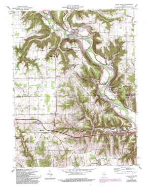
Cedar Grove Topo Map Indiana
To zoom in, hover over the map of Cedar Grove
USGS Topo Quad 39084c8 - 1:24,000 scale
| Topo Map Name: | Cedar Grove |
| USGS Topo Quad ID: | 39084c8 |
| Print Size: | ca. 21 1/4" wide x 27" high |
| Southeast Coordinates: | 39.25° N latitude / 84.875° W longitude |
| Map Center Coordinates: | 39.3125° N latitude / 84.9375° W longitude |
| U.S. State: | IN |
| Filename: | o39084c8.jpg |
| Download Map JPG Image: | Cedar Grove topo map 1:24,000 scale |
| Map Type: | Topographic |
| Topo Series: | 7.5´ |
| Map Scale: | 1:24,000 |
| Source of Map Images: | United States Geological Survey (USGS) |
| Alternate Map Versions: |
Cedar Grove IN 1955, updated 1957 Download PDF Buy paper map Cedar Grove IN 1974, updated 1975 Download PDF Buy paper map Cedar Grove IN 1974, updated 1988 Download PDF Buy paper map Cedar Grove IN 1974, updated 1994 Download PDF Buy paper map Cedar Grove IN 1974, updated 1994 Download PDF Buy paper map Cedar Grove IN 2010 Download PDF Buy paper map Cedar Grove IN 2013 Download PDF Buy paper map Cedar Grove IN 2016 Download PDF Buy paper map |
1:24,000 Topo Quads surrounding Cedar Grove
> Back to 39084a1 at 1:100,000 scale
> Back to 39084a1 at 1:250,000 scale
> Back to U.S. Topo Maps home
Cedar Grove topo map: Gazetteer
Cedar Grove: Dams
J Maxwell Pond Dam elevation 265m 869′Cedar Grove: Parks
Camp Lenmary elevation 188m 616′Camp Olden elevation 176m 577′
Cedar Grove: Populated Places
Ashby (historical) elevation 173m 567′Cedar Grove elevation 183m 600′
New Trenton elevation 187m 613′
Saint Leon elevation 308m 1010′
South Gate elevation 312m 1023′
Cedar Grove: Reservoirs
J Maxwell Pond elevation 265m 869′Lake Roseanna elevation 248m 813′
Cedar Grove: Ridges
Chappelow Ridge elevation 277m 908′Dog Ridge elevation 294m 964′
Ennis Ridge elevation 281m 921′
Gaynor Ridge elevation 282m 925′
Cedar Grove: Streams
Big Cedar Creek elevation 170m 557′Blackburn Creek elevation 164m 538′
Bull Run elevation 165m 541′
Elkhorn Creek elevation 164m 538′
Gobbles Creek elevation 173m 567′
McCann Creek elevation 167m 547′
Ramsey Creek elevation 167m 547′
Richland Creek elevation 180m 590′
Shingle Creek elevation 182m 597′
Whistle Creek elevation 162m 531′
Cedar Grove: Summits
Elkhorn Hill elevation 308m 1010′English Hill elevation 304m 997′
Gobblers Knob Hill elevation 301m 987′
Long Hollow Hill elevation 296m 971′
New Trenton Hill elevation 287m 941′
South Gate Hill elevation 297m 974′
Wee Wee Hill elevation 299m 980′
Whites Hill elevation 273m 895′
Cedar Grove: Valleys
Buzzard Hollow elevation 192m 629′Cedar Grove digital topo map on disk
Buy this Cedar Grove topo map showing relief, roads, GPS coordinates and other geographical features, as a high-resolution digital map file on DVD:
Northern Illinois, Northern Indiana & Southwestern Michigan
Buy digital topo maps: Northern Illinois, Northern Indiana & Southwestern Michigan


