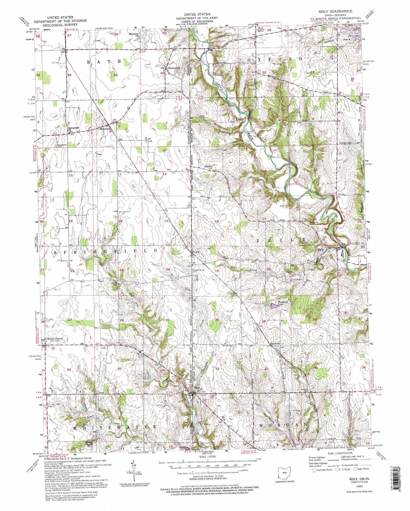
Reily Topo Map Ohio
To zoom in, hover over the map of Reily
USGS Topo Quad 39084d7 - 1:24,000 scale
| Topo Map Name: | Reily |
| USGS Topo Quad ID: | 39084d7 |
| Print Size: | ca. 21 1/4" wide x 27" high |
| Southeast Coordinates: | 39.375° N latitude / 84.75° W longitude |
| Map Center Coordinates: | 39.4375° N latitude / 84.8125° W longitude |
| U.S. States: | OH, IN |
| Filename: | o39084d7.jpg |
| Download Map JPG Image: | Reily topo map 1:24,000 scale |
| Map Type: | Topographic |
| Topo Series: | 7.5´ |
| Map Scale: | 1:24,000 |
| Source of Map Images: | United States Geological Survey (USGS) |
| Alternate Map Versions: |
Reily OH 1955, updated 1956 Download PDF Buy paper map Reily OH 1955, updated 1966 Download PDF Buy paper map Reily OH 1955, updated 1971 Download PDF Buy paper map Reily OH 1992, updated 1995 Download PDF Buy paper map Reily OH 2010 Download PDF Buy paper map Reily OH 2013 Download PDF Buy paper map Reily OH 2016 Download PDF Buy paper map |
1:24,000 Topo Quads surrounding Reily
Brownsville |
Liberty |
Fairhaven |
Eaton South |
West Alexandria |
Everton |
New Fairfield |
College Corner |
Oxford |
West Elkton |
Brookville |
Whitcomb |
Reily |
Millville |
Hamilton |
Spades |
Cedar Grove |
Harrison |
Shandon |
Greenhills |
Sunman |
Guilford |
Hooven |
Addyston |
Cincinnati West |
> Back to 39084a1 at 1:100,000 scale
> Back to 39084a1 at 1:250,000 scale
> Back to U.S. Topo Maps home
Reily topo map: Gazetteer
Reily: Bridges
Bebb Park Bridge elevation 232m 761′Reily: Dams
Bartmess Lake Dam elevation 243m 797′Reily: Parks
Indian Creek Preserve elevation 246m 807′Reily: Populated Places
Mixersville elevation 305m 1000′Mount Carmel elevation 311m 1020′
Newkirk elevation 280m 918′
Peoria elevation 306m 1003′
Raymond elevation 311m 1020′
Reily elevation 229m 751′
Scipio elevation 256m 839′
Reily: Post Offices
Reily Post Office (historical) elevation 228m 748′Springfield Post Office (historical) elevation 311m 1020′
Reily: Reservoirs
Bartmess Lake elevation 243m 797′Woodside Lake elevation 277m 908′
Reily: Streams
Little Indian Creek elevation 222m 728′Little Indian Creek elevation 222m 728′
Phillips Creek elevation 239m 784′
Phillips Creek elevation 239m 784′
Tent Brook elevation 268m 879′
Reily digital topo map on disk
Buy this Reily topo map showing relief, roads, GPS coordinates and other geographical features, as a high-resolution digital map file on DVD:
Northern Illinois, Northern Indiana & Southwestern Michigan
Buy digital topo maps: Northern Illinois, Northern Indiana & Southwestern Michigan