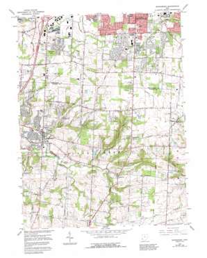
Springboro Topo Map Ohio
To zoom in, hover over the map of Springboro
USGS Topo Quad 39084e2 - 1:24,000 scale
| Topo Map Name: | Springboro |
| USGS Topo Quad ID: | 39084e2 |
| Print Size: | ca. 21 1/4" wide x 27" high |
| Southeast Coordinates: | 39.5° N latitude / 84.125° W longitude |
| Map Center Coordinates: | 39.5625° N latitude / 84.1875° W longitude |
| U.S. State: | OH |
| Filename: | o39084e2.jpg |
| Download Map JPG Image: | Springboro topo map 1:24,000 scale |
| Map Type: | Topographic |
| Topo Series: | 7.5´ |
| Map Scale: | 1:24,000 |
| Source of Map Images: | United States Geological Survey (USGS) |
| Alternate Map Versions: |
Springboro OH 1955, updated 1956 Download PDF Buy paper map Springboro OH 1965, updated 1967 Download PDF Buy paper map Springboro OH 1965, updated 1976 Download PDF Buy paper map Springboro OH 1965, updated 1982 Download PDF Buy paper map Springboro OH 1965, updated 1992 Download PDF Buy paper map Springboro OH 2010 Download PDF Buy paper map Springboro OH 2013 Download PDF Buy paper map Springboro OH 2016 Download PDF Buy paper map |
1:24,000 Topo Quads surrounding Springboro
> Back to 39084e1 at 1:100,000 scale
> Back to 39084a1 at 1:250,000 scale
> Back to U.S. Topo Maps home
Springboro topo map: Gazetteer
Springboro: Airports
Dayton General Airport South elevation 289m 948′Skyland Airport elevation 278m 912′
Sycamore Hospital Heliport elevation 267m 875′
Springboro: Dams
Lake Forest Dam elevation 259m 849′Old Stage Farms Lake Dam elevation 306m 1003′
Stolle Lake Dam elevation 268m 879′
Springboro: Parks
Benjamin Archer Park elevation 302m 990′Concept Park elevation 286m 938′
Kessling Park elevation 256m 839′
Lair Park elevation 289m 948′
Nutt Woods Park elevation 292m 958′
Quail Run Park elevation 294m 964′
Rosewood Park elevation 292m 958′
Stringtown Park elevation 288m 944′
Sugar Valley Park elevation 271m 889′
Waldruhe Park elevation 305m 1000′
Watkins Glen Park elevation 289m 948′
Western Park elevation 281m 921′
Springboro: Populated Places
Edgewood (historical) elevation 303m 994′Five Points elevation 302m 990′
Flat Iron elevation 247m 810′
Kenricksville elevation 308m 1010′
Kitchener (historical) elevation 290m 951′
Lytle elevation 314m 1030′
Manor (historical) elevation 301m 987′
Oakwood Village elevation 279m 915′
Pekin elevation 289m 948′
Ridgeville elevation 263m 862′
Royal Springs Estates elevation 278m 912′
Springboro elevation 236m 774′
Tamarack Hills elevation 270m 885′
Venable (historical) elevation 287m 941′
Springboro: Reservoirs
Lake Forest elevation 259m 849′Old Stage Farms Lake elevation 306m 1003′
Stolle Lake elevation 268m 879′
Springboro: Streams
Beech Run elevation 236m 774′Bull Run elevation 228m 748′
Cooks Run elevation 257m 843′
Coon Creek elevation 225m 738′
Dugans Run elevation 237m 777′
Emleys Run elevation 268m 879′
Lower Mad Run elevation 240m 787′
Rapid Run elevation 238m 780′
Richards Run elevation 238m 780′
Rileys Run elevation 246m 807′
Rosers Run elevation 253m 830′
Springboro digital topo map on disk
Buy this Springboro topo map showing relief, roads, GPS coordinates and other geographical features, as a high-resolution digital map file on DVD:
Northern Illinois, Northern Indiana & Southwestern Michigan
Buy digital topo maps: Northern Illinois, Northern Indiana & Southwestern Michigan


