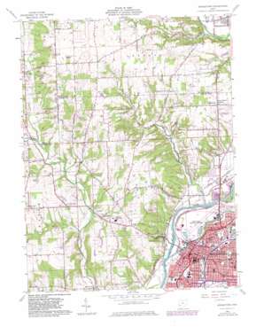
Middletown Topo Map Ohio
To zoom in, hover over the map of Middletown
USGS Topo Quad 39084e4 - 1:24,000 scale
| Topo Map Name: | Middletown |
| USGS Topo Quad ID: | 39084e4 |
| Print Size: | ca. 21 1/4" wide x 27" high |
| Southeast Coordinates: | 39.5° N latitude / 84.375° W longitude |
| Map Center Coordinates: | 39.5625° N latitude / 84.4375° W longitude |
| U.S. State: | OH |
| Filename: | o39084e4.jpg |
| Download Map JPG Image: | Middletown topo map 1:24,000 scale |
| Map Type: | Topographic |
| Topo Series: | 7.5´ |
| Map Scale: | 1:24,000 |
| Source of Map Images: | United States Geological Survey (USGS) |
| Alternate Map Versions: |
Middletown OH 1959, updated 1961 Download PDF Buy paper map Middletown OH 1959, updated 1971 Download PDF Buy paper map Middletown OH 1959, updated 1975 Download PDF Buy paper map Middletown OH 1959, updated 1982 Download PDF Buy paper map Middletown OH 1959, updated 1982 Download PDF Buy paper map Middletown OH 2010 Download PDF Buy paper map Middletown OH 2013 Download PDF Buy paper map Middletown OH 2016 Download PDF Buy paper map |
1:24,000 Topo Quads surrounding Middletown
> Back to 39084e1 at 1:100,000 scale
> Back to 39084a1 at 1:250,000 scale
> Back to U.S. Topo Maps home
Middletown topo map: Gazetteer
Middletown: Airports
Hook Field Municipal Airport elevation 197m 646′Jims Airport elevation 284m 931′
Middletown Hospital Heliport elevation 216m 708′
Middletown: Canals
Middletown Hydraulic Canal elevation 198m 649′Middletown: Dams
Black Lake Dam elevation 213m 698′Guffey Lake Dam elevation 242m 793′
Middletown Sportsmen Club Dam elevation 249m 816′
Will-O-Bob Lake Dam elevation 241m 790′
Middletown: Parks
Avalon Park elevation 199m 652′Barnitz Park elevation 197m 646′
Barnitz Stadium elevation 196m 643′
Bicentennial Commons elevation 192m 629′
Crawford Park elevation 202m 662′
Doty Park elevation 200m 656′
Flemming Park elevation 201m 659′
Gardner Park elevation 201m 659′
Gladell Park elevation 216m 708′
Goldman Park elevation 207m 679′
Kercher Park elevation 219m 718′
Miami Park elevation 203m 666′
Oakland Park elevation 200m 656′
Old South Park elevation 196m 643′
Ratham Park elevation 196m 643′
Sebald Park elevation 267m 875′
Sherman Park elevation 203m 666′
Smith Park elevation 197m 646′
South Main Street Historic District elevation 196m 643′
Sunset Park elevation 209m 685′
University Park elevation 204m 669′
Middletown: Populated Places
Astoria elevation 244m 800′Avalon elevation 200m 656′
Browns Chapel elevation 293m 961′
Catalina Mobile Home Park elevation 202m 662′
Greenbush elevation 283m 928′
Harlan Park elevation 198m 649′
Middletown elevation 200m 656′
Miltonville elevation 204m 669′
Mudlick elevation 226m 741′
Oakland elevation 200m 656′
Poast Town elevation 198m 649′
Poast Town Heights elevation 264m 866′
Rose Lawn elevation 204m 669′
South Highlands elevation 219m 718′
Upper Arlington elevation 216m 708′
West Middletown elevation 199m 652′
Middletown: Post Offices
Astoria Post Office (historical) elevation 247m 810′Greenbush Post Office (historical) elevation 283m 928′
Middletown Post Office elevation 199m 652′
Miltonville Post Office (historical) elevation 204m 669′
Poast Town Post Office (historical) elevation 198m 649′
West Middletown Post Office (historical) elevation 199m 652′
Middletown: Reservoirs
Black Pond elevation 213m 698′Elk Creek Lake elevation 295m 967′
Guffey Lake elevation 242m 793′
Middletown Sportsmen Club Lake elevation 249m 816′
Will-O-Bob Lake elevation 241m 790′
Middletown: Streams
Browns Run elevation 195m 639′Dry Run elevation 217m 711′
Middletown digital topo map on disk
Buy this Middletown topo map showing relief, roads, GPS coordinates and other geographical features, as a high-resolution digital map file on DVD:
Northern Illinois, Northern Indiana & Southwestern Michigan
Buy digital topo maps: Northern Illinois, Northern Indiana & Southwestern Michigan


