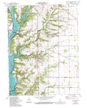
New Fairfield Topo Map Indiana
To zoom in, hover over the map of New Fairfield
USGS Topo Quad 39084e8 - 1:24,000 scale
| Topo Map Name: | New Fairfield |
| USGS Topo Quad ID: | 39084e8 |
| Print Size: | ca. 21 1/4" wide x 27" high |
| Southeast Coordinates: | 39.5° N latitude / 84.875° W longitude |
| Map Center Coordinates: | 39.5625° N latitude / 84.9375° W longitude |
| U.S. State: | IN |
| Filename: | o39084e8.jpg |
| Download Map JPG Image: | New Fairfield topo map 1:24,000 scale |
| Map Type: | Topographic |
| Topo Series: | 7.5´ |
| Map Scale: | 1:24,000 |
| Source of Map Images: | United States Geological Survey (USGS) |
| Alternate Map Versions: |
Fairfield IN 1948 Download PDF Buy paper map Fairfield IN 1960, updated 1962 Download PDF Buy paper map Fairfield IN 1960, updated 1962 Download PDF Buy paper map New Fairfield IN 1974, updated 1975 Download PDF Buy paper map New Fairfield IN 1974, updated 1982 Download PDF Buy paper map New Fairfield IN 1974, updated 1994 Download PDF Buy paper map New Fairfield IN 2010 Download PDF Buy paper map New Fairfield IN 2013 Download PDF Buy paper map New Fairfield IN 2016 Download PDF Buy paper map |
1:24,000 Topo Quads surrounding New Fairfield
> Back to 39084e1 at 1:100,000 scale
> Back to 39084a1 at 1:250,000 scale
> Back to U.S. Topo Maps home
New Fairfield topo map: Gazetteer
New Fairfield: Dams
Whitewater State Park Lake Dam elevation 255m 836′New Fairfield: Parks
Whitewater State Park elevation 254m 833′New Fairfield: Populated Places
Billingsville elevation 314m 1030′Dunlapsville elevation 236m 774′
Fairfield elevation 228m 748′
Lotus elevation 318m 1043′
New Fairfield elevation 299m 980′
Old Bath elevation 315m 1033′
Roseburg elevation 281m 921′
Salem elevation 318m 1043′
New Fairfield: Reservoirs
Whitewater Lake elevation 255m 836′New Fairfield: Streams
Bath Creek elevation 309m 1013′Blue Lick elevation 291m 954′
Dubois Creek elevation 228m 748′
Salem Branch elevation 268m 879′
Silver Creek elevation 228m 748′
New Fairfield digital topo map on disk
Buy this New Fairfield topo map showing relief, roads, GPS coordinates and other geographical features, as a high-resolution digital map file on DVD:
Northern Illinois, Northern Indiana & Southwestern Michigan
Buy digital topo maps: Northern Illinois, Northern Indiana & Southwestern Michigan


